MyTopo
Goat Camp Spring New Mexico US Topo Map
Couldn't load pickup availability
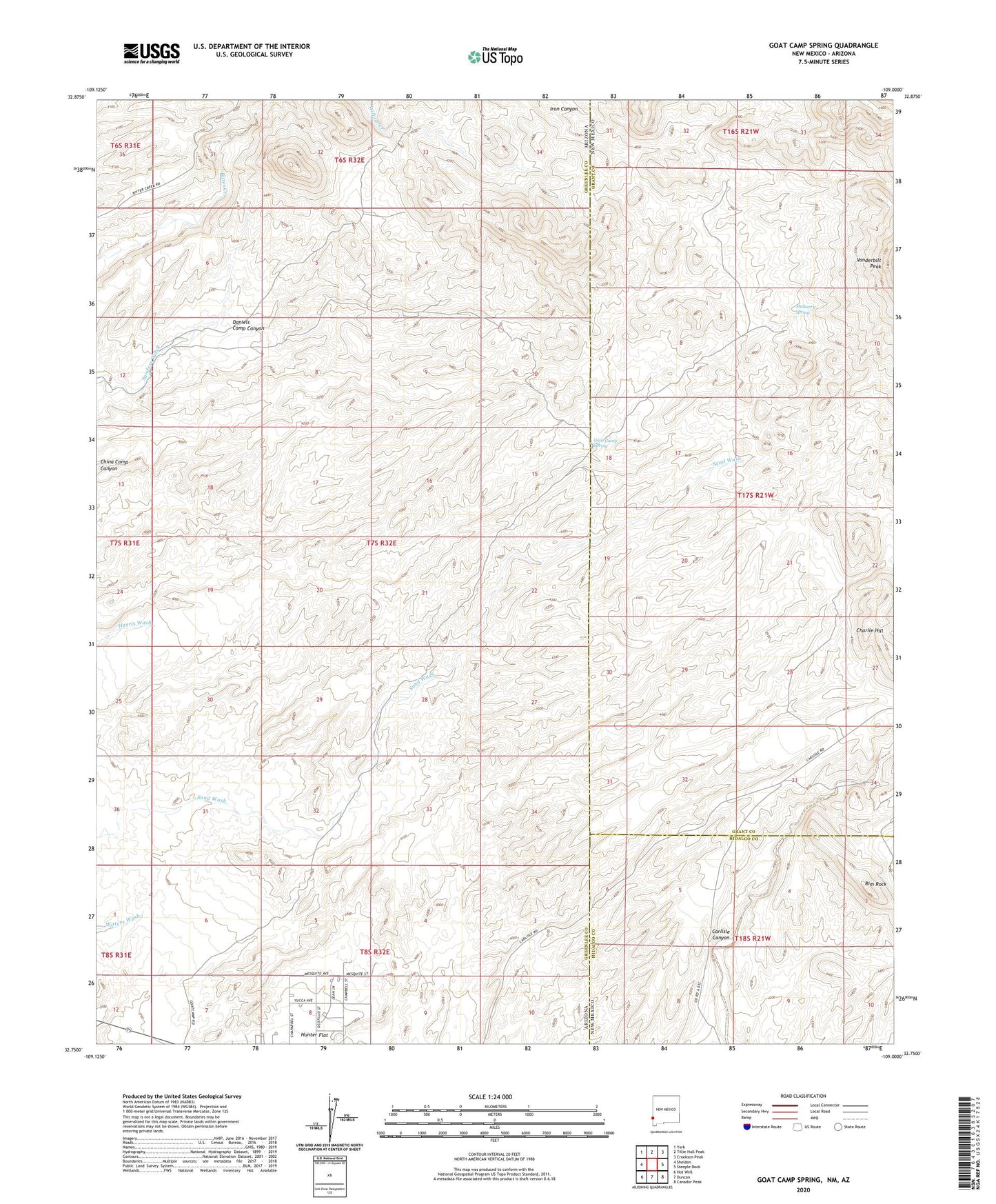
2023 topographic map quadrangle Goat Camp Spring in the states of Arizona, New Mexico. Scale: 1:24000. Based on the newly updated USGS 7.5' US Topo map series, this map is in the following counties: Grant, Greenlee, Hidalgo. The map contains contour data, water features, and other items you are used to seeing on USGS maps, but also has updated roads and other features. This is the next generation of topographic maps. Printed on high-quality waterproof paper with UV fade-resistant inks.
Quads adjacent to this one:
West: Sheldon
Northwest: York
North: Tillie Hall Peak
Northeast: Crookson Peak
East: Steeple Rock
Southeast: Canador Peak
South: Duncan
Southwest: Hot Well
This map covers the same area as the classic USGS quad with code o32109g1.
Contains the following named places: Arimex, Charlie Hill, Daniels Camp Canyon, Goat Camp Spring, Jack Steel Tank, Mulberry Spring, Rim Rock, Stevens Ranch, Town of Duncan