MyTopo
Williams Ranch New Mexico US Topo Map
Couldn't load pickup availability
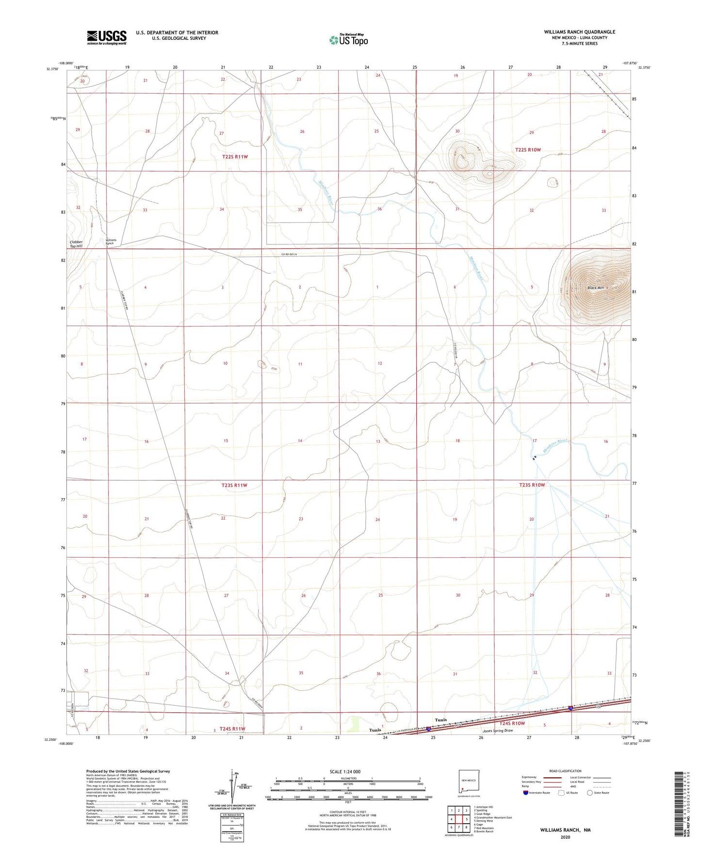
2023 topographic map quadrangle Williams Ranch in the state of New Mexico. Scale: 1:24000. Based on the newly updated USGS 7.5' US Topo map series, this map is in the following counties: Luna. The map contains contour data, water features, and other items you are used to seeing on USGS maps, but also has updated roads and other features. This is the next generation of topographic maps. Printed on high-quality waterproof paper with UV fade-resistant inks.
Quads adjacent to this one:
West: Grandmother Mountain East
Northwest: Antelope Hill
North: Spalding
Northeast: Goat Ridge
East: Deming West
Southeast: Bowlin Ranch
South: Red Mountain
Southwest: Gage
This map covers the same area as the classic USGS quad with code o32107c8.
Contains the following named places: 00161 Water Well, 00576 Water Well, 01240 Water Well, 01241 Water Well, 01252 Water Well, 01254 Water Well, 01356 Water Well, 01357 Water Well, 01362 Water Well, 01363 Water Well, 01364 Water Well, 01384 Water Well, 06089 Water Well, 06090 Water Well, 06091 Water Well, 06139 Water Well, 1360 Water Well, 1382 Water Well, Black Mountain, Lauer, M-366 Water Well, Middle Well, North Windmill, Number 1256 Water Well, South Windmill, Tunis, Williams Ranch, Willis