MyTopo
Sunshine New Mexico US Topo Map
Couldn't load pickup availability
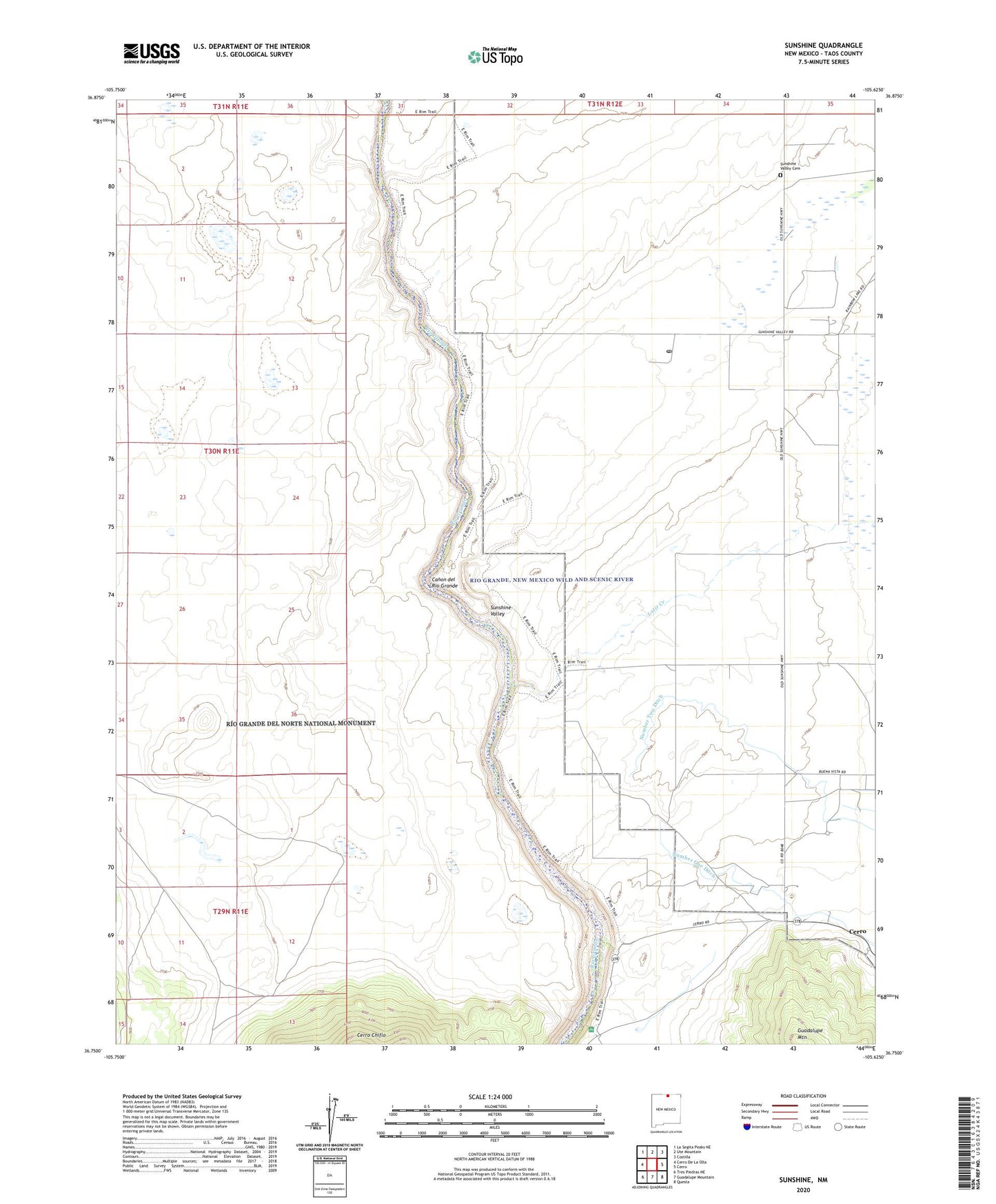
2023 topographic map quadrangle Sunshine in the state of New Mexico. Scale: 1:24000. Based on the newly updated USGS 7.5' US Topo map series, this map is in the following counties: Taos. The map contains contour data, water features, and other items you are used to seeing on USGS maps, but also has updated roads and other features. This is the next generation of topographic maps. Printed on high-quality waterproof paper with UV fade-resistant inks.
Quads adjacent to this one:
West: Cerro De La Olla
Northwest: La Segita Peaks NE
North: Ute Mountain
Northeast: Costilla
East: Cerro
Southeast: Questa
South: Guadalupe Mountain
Southwest: Tres Piedras NE
This map covers the same area as the classic USGS quad with code o36105g6.
Contains the following named places: 10031 Water Well, 10033 Water Well, 10053 Water Well, 87519, Chiflo Game Water Unit, Latir Creek, Number One Ditch, PubSup Water Well 2, Sheep Crossing Campground, Sunshine, Sunshine Valley, Sunshine Valley Cemetery, Sunshine Valley Post Office, Test Hole R2 Water Well, Test Hole R5 Water Well, Testhole 2 Water Well, Testhole 5 Water Well, Testhole R1 Water Well, Well 1 Water Well, Well 4 Water Well