MyTopo
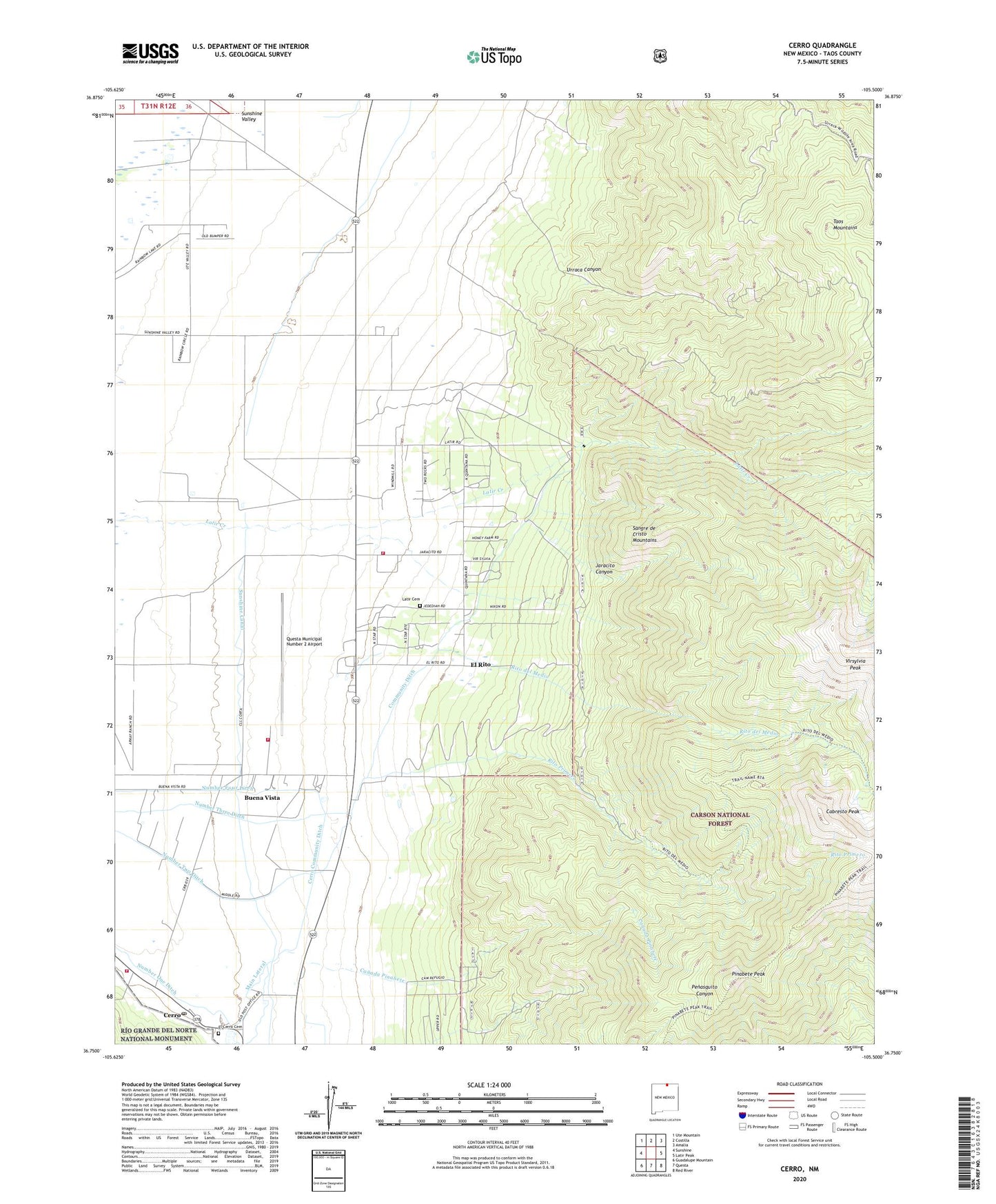
Cerro New Mexico US Topo Map
Couldn't load pickup availability
Also explore the Cerro Forest Service Topo of this same quad for updated USFS data
2023 topographic map quadrangle Cerro in the state of New Mexico. Scale: 1:24000. Based on the newly updated USGS 7.5' US Topo map series, this map is in the following counties: Taos. The map contains contour data, water features, and other items you are used to seeing on USGS maps, but also has updated roads and other features. This is the next generation of topographic maps. Printed on high-quality waterproof paper with UV fade-resistant inks.
Quads adjacent to this one:
West: Sunshine
Northwest: Ute Mountain
North: Costilla
Northeast: Amalia
East: Latir Peak
Southeast: Red River
South: Questa
Southwest: Guadalupe Mountain
This map covers the same area as the classic USGS quad with code o36105g5.
Contains the following named places: 10021 Water Well, 10022 Water Well, 10026 Water Well, 10032 Water Well, 10051 Water Well, 10054 WAter Well, 10055 Water Well, 10108 Water Well, 10110 Water Well, 10111 Water Well, 10112 Water Well, Buena Vista, Cabresto Lake Dam, Cabresto Peak, Canada Pinabete, Cerro, Cerro Community Ditch, Cerro Post Office, Cerro Volunteer Fire Department, Cerro Weather Station, Community Ditch, El Cerro Cemetery, El Rito, Esperanza Claim, Jaracito Canyon, Latir Cemetery, Latir Peak Wilderness, Latir Volunteer Fire Department, Main Lateral, Number Four Ditch, Number Three Ditch, Number Two Ditch, Pinabete Canyon, Pinabete Peak, PUBSUP Water Well 1, Questa Fire Department Station 2 - Questa Airport Substation, Questa Municipal Number 2 Airport, Revelation Manganese D Mine, Rito del Medio, Rito Primero, Sawmill Canyon Prospect, Sunshine Canal, Testhole R4 Water Well, Urraca Canyon, Water Well 1, Water Well 2, Water Well 3