MyTopo
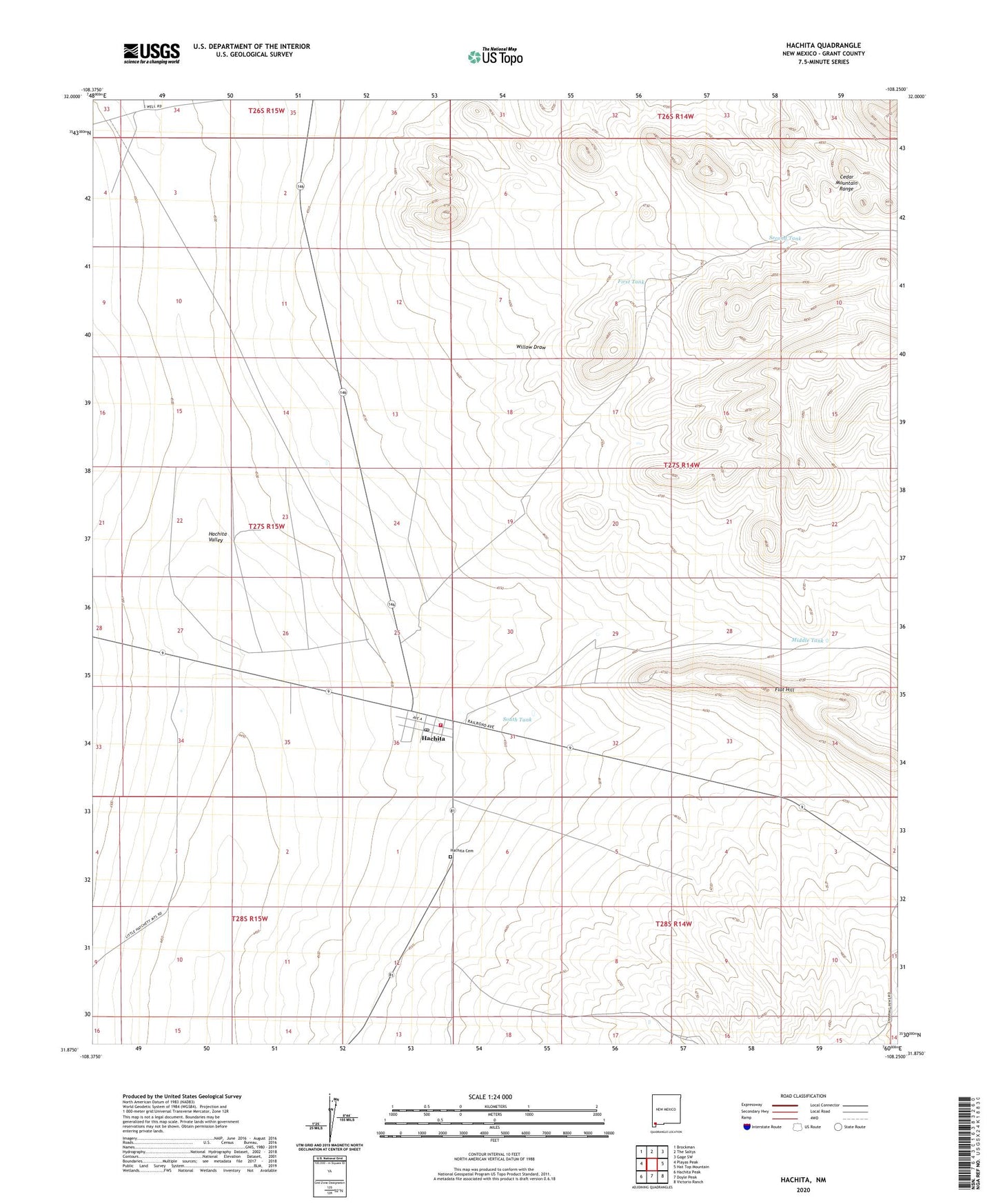
Hachita New Mexico US Topo Map
Couldn't load pickup availability
2020 topographic map quadrangle Hachita in the state of New Mexico. Scale: 1:24000. Based on the newly updated USGS 7.5' US Topo map series, this map is in the following counties: Grant. The map contains contour data, water features, and other items you are used to seeing on USGS maps, but also has updated roads and other features. This is the next generation of topographic maps. Printed on high-quality waterproof paper with UV fade-resistant inks.
Quads adjacent to this one:
West: Playas Peak
Northwest: Brockman
North: The Saltys
Northeast: Gage SW
East: Hat Top Mountain
Southeast: Victorio Ranch
South: Doyle Peak
Southwest: Hachita Peak
Contains the following named places: 2 Mile Wind Mill Water Well, Brushy Tank, C C Tank, First Tank, Flat Hill, Hachita, Hachita Baptist Church, Hachita Cemetery, Hachita Census Designated Place, Hachita Post Office, Hachita Weather Station, Middle Tank, Old Hatchet Mine Historic Site, Second Tank, South Tank, Tyrone Volunteer Fire Department Hachita, Victorio Cattle Company, West Well Water Well, Willow Draw