MyTopo
Victorio Ranch New Mexico US Topo Map
Couldn't load pickup availability
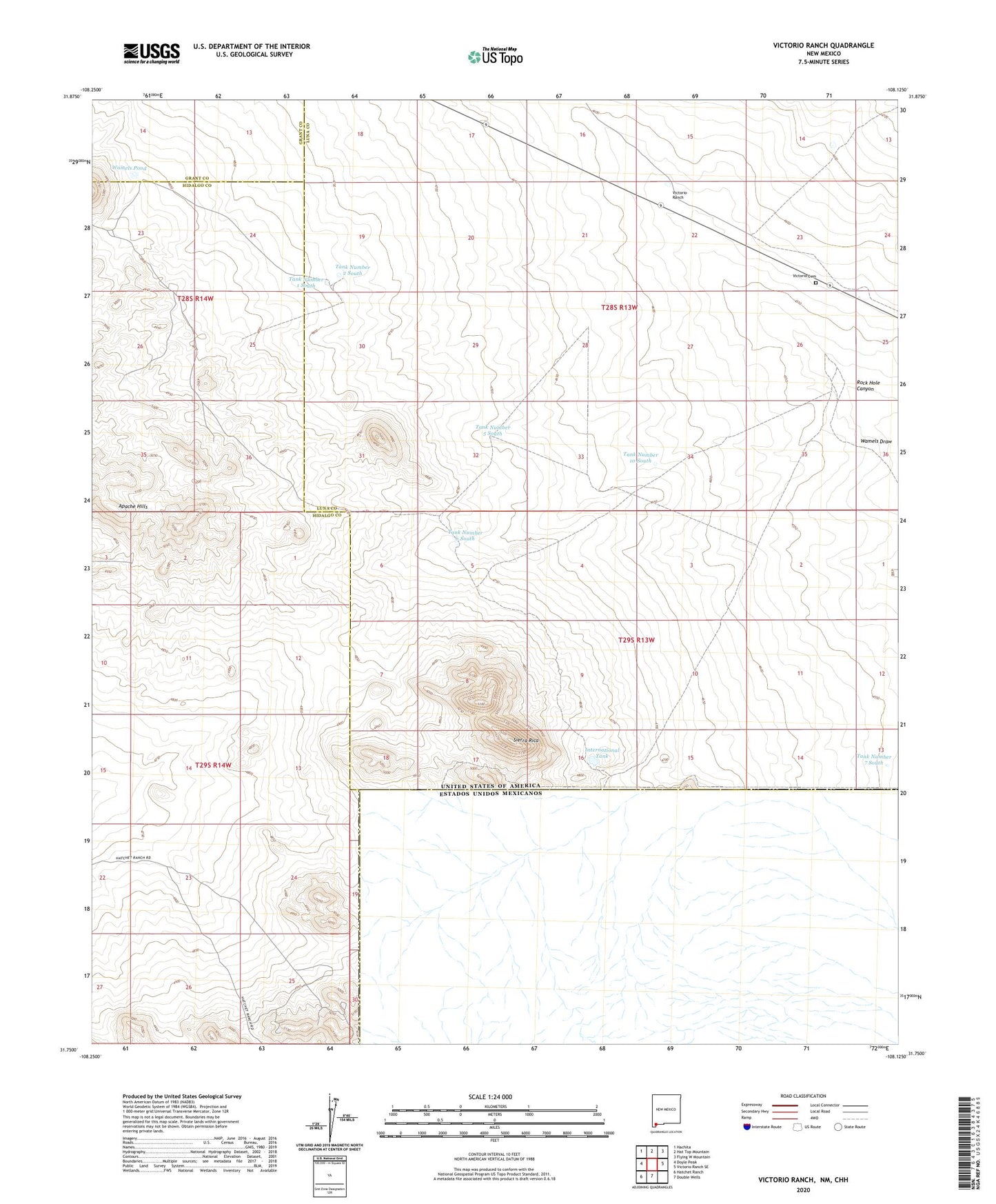
2023 topographic map quadrangle Victorio Ranch in the state of New Mexico. Scale: 1:24000. Based on the newly updated USGS 7.5' US Topo map series, this map is in the following counties: Luna, Hidalgo, Grant. The map contains contour data, water features, and other items you are used to seeing on USGS maps, but also has updated roads and other features. This is the next generation of topographic maps. Printed on high-quality waterproof paper with UV fade-resistant inks.
Quads adjacent to this one:
West: Doyle Peak
Northwest: Hachita
North: Hat Top Mountain
Northeast: Flying W Mountain
East: Victorio Ranch SE
South: Double Wells
Southwest: Hatchet Ranch
This map covers the same area as the classic USGS quad with code o31108g2.
Contains the following named places: 06078 Water Well, American Mine, Barnett Mine, Centre Claim, Copper King Claim, Doyle Mine, Doyles Well, Ford Prospects, International, International Mine, International Tank, Mammoth Lode, Napane Mine, Nutshell Mine, Occidental Mine, Occidental Mines, Owens Mine, Queens Taste Mine, Rock Hole Canyon, Southwest Windmill, Tank Number 1 South, Tank Number 10 South, Tank Number 2 South, Tank Number 5 South, Tank Number 6 South, Tank Number 7 South, Victorio Cemetery, Victorio Ranch, Wamels Pond, Wamels Upper Well, West Water Well, Yucca Claim