MyTopo
Strawberry Peak New Mexico US Topo Map
Couldn't load pickup availability
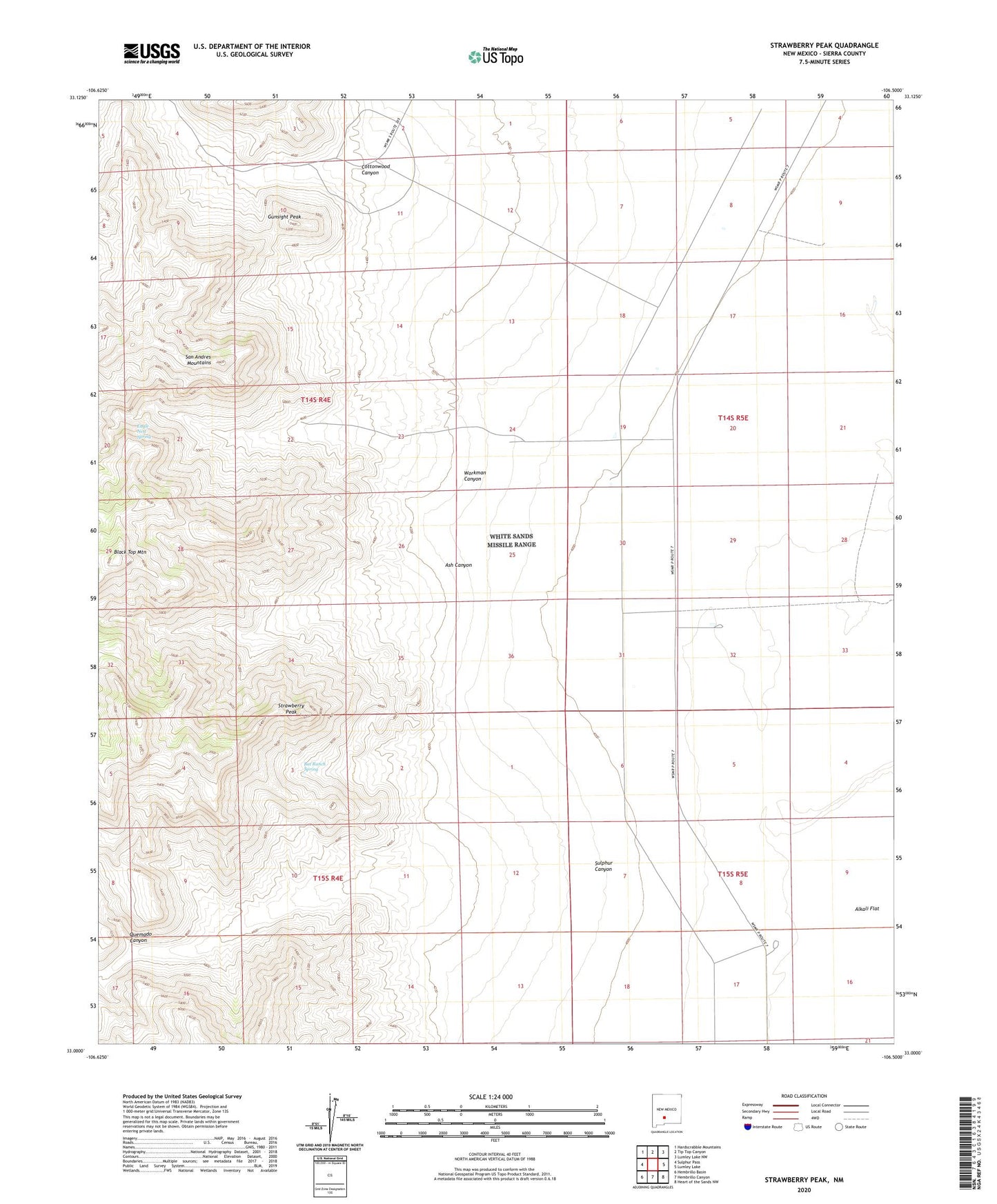
2023 topographic map quadrangle Strawberry Peak in the state of New Mexico. Scale: 1:24000. Based on the newly updated USGS 7.5' US Topo map series, this map is in the following counties: Sierra. The map contains contour data, water features, and other items you are used to seeing on USGS maps, but also has updated roads and other features. This is the next generation of topographic maps. Printed on high-quality waterproof paper with UV fade-resistant inks.
Quads adjacent to this one:
West: Sulphur Pass
Northwest: Hardscrabble Mountains
North: Tip Top Canyon
Northeast: Lumley Lake NW
East: Lumley Lake
Southeast: Heart of the Sands NW
South: Hembrillo Canyon
Southwest: Hembrillo Basin
This map covers the same area as the classic USGS quad with code o33106a5.
Contains the following named places: Ash Canyon, Bat Ranch Spring, Black Top Mountain, Cave Spar, Cottonwood Canyon, Eagle Nest Spring, Governor Group, Gunsight Peak, Harding Deposit, Henderson Well, Independence Mine, L H Makinson, Moore Well, Nelson Well, Quemado Canyon, Strawberry Peak, Sulphur Canyon, Workman Canyon