MyTopo
Sulphur Pass New Mexico US Topo Map
Couldn't load pickup availability
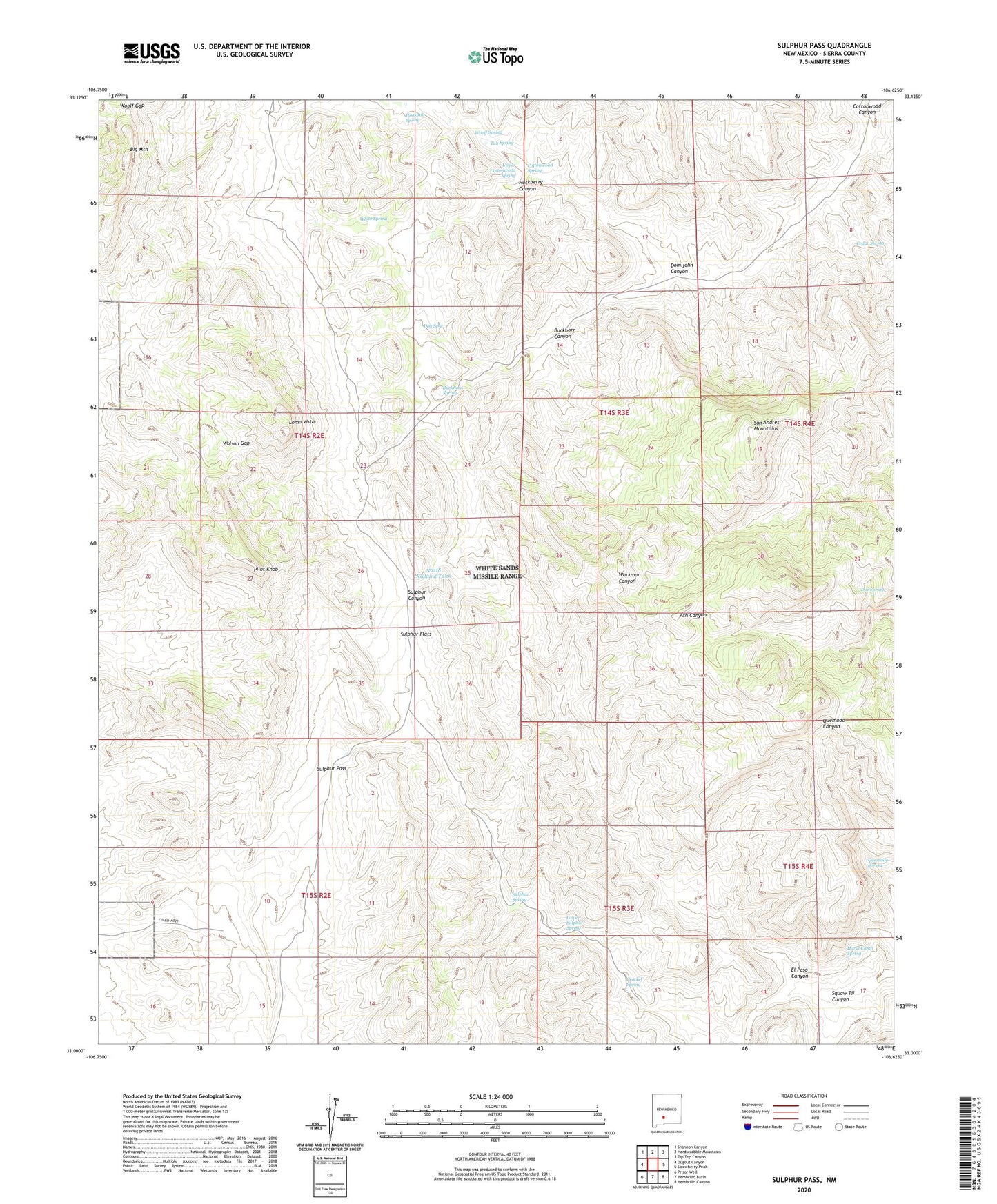
2023 topographic map quadrangle Sulphur Pass in the state of New Mexico. Scale: 1:24000. Based on the newly updated USGS 7.5' US Topo map series, this map is in the following counties: Sierra. The map contains contour data, water features, and other items you are used to seeing on USGS maps, but also has updated roads and other features. This is the next generation of topographic maps. Printed on high-quality waterproof paper with UV fade-resistant inks.
Quads adjacent to this one:
West: Dugout Canyon
Northwest: Shannon Canyon
North: Hardscrabble Mountains
Northeast: Tip Top Canyon
East: Strawberry Peak
Southeast: Hembrillo Canyon
South: Hembrillo Basin
Southwest: Prisor Well
This map covers the same area as the classic USGS quad with code o33106a6.
Contains the following named places: Ben Taylor Tank, Big Mountain, Buckhorn Canyon, Buckhorn Spring, Cedar Spring, Cottonwood Spring, Crocket Spring, Doe Spring, Dog Seep, Domijohn Canyon, Domijohn Well, El Paso Canyon, Esque Spring, Floyd Crockett Ranch, Frank Crockett Ranch Headquarters, Hackberry Canyon, Hackberry Spring, Holcomb Spring, Horse Camp Spring, Loma Vista, Lower Sulphur Spring, Murray Well, New Well, North Richard Tank, Pilot Knob, Quemado Spring, Richard Tank, Rock House Well, San Andres Mountains, Squaw Tit Canyon, Sulphur Flats, Sulphur Pass, Sulphur Spring, Taylor Tank, Tub Spring, Upper Cottonwood Spring, Walson Gap, Walson Well, White Spring, Woolf Gap, Woolf Ranch Headquarters, Woolf Spring