MyTopo
Hondo Reservoir New Mexico US Topo Map
Couldn't load pickup availability
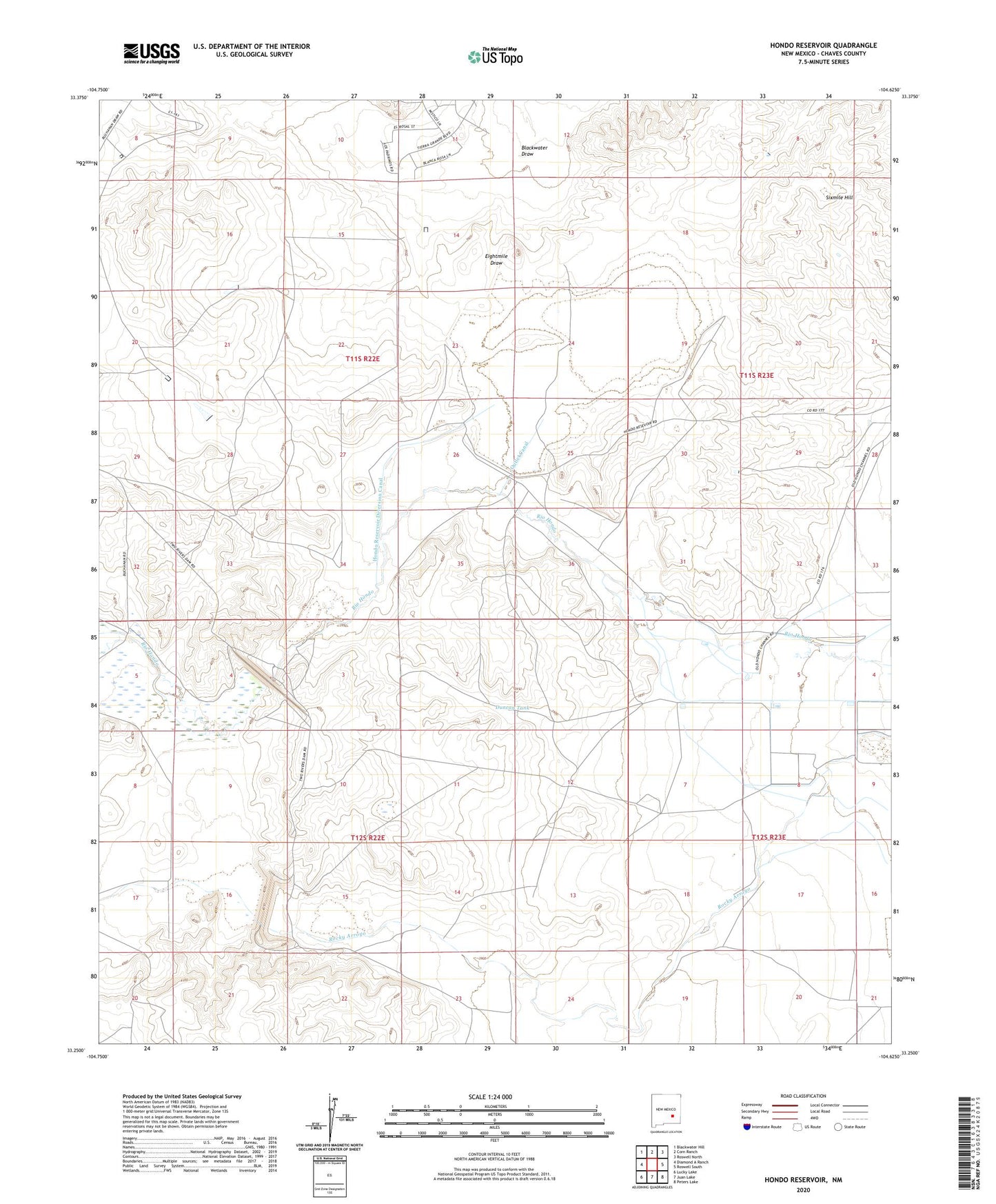
2023 topographic map quadrangle Hondo Reservoir in the state of New Mexico. Scale: 1:24000. Based on the newly updated USGS 7.5' US Topo map series, this map is in the following counties: Chaves. The map contains contour data, water features, and other items you are used to seeing on USGS maps, but also has updated roads and other features. This is the next generation of topographic maps. Printed on high-quality waterproof paper with UV fade-resistant inks.
Quads adjacent to this one:
West: Diamond A Ranch
Northwest: Blackwater Hill
North: Corn Ranch
Northeast: Roswell North
East: Roswell South
Southeast: Peters Lake
South: Juan Lake
Southwest: Lucky Lake
This map covers the same area as the classic USGS quad with code o33104c6.
Contains the following named places: Blackwater Draw, Bloom Ranch, Bloom Well, Coles Camp, Duncan Tank, Farrar Well, Hondo Ditch, Hondo Irrigation Project, Hondo Reservoir, Hondo Reservoir Diversion Canal, Lambert Well, Lower Mill, Missouri Plaza, Missouri Plaza Indian Ruins, Number 15 Well, Outlet Canal, Red House Well, Sherman Place, Two Rivers Reservoir, Woods Ranch