MyTopo
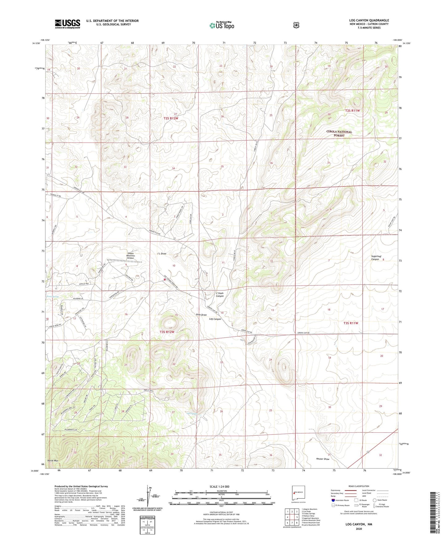
Log Canyon New Mexico US Topo Map
Couldn't load pickup availability
Also explore the Log Canyon Forest Service Topo of this same quad for updated USFS data
2023 topographic map quadrangle Log Canyon in the state of New Mexico. Scale: 1:24000. Based on the newly updated USGS 7.5' US Topo map series, this map is in the following counties: Catron. The map contains contour data, water features, and other items you are used to seeing on USGS maps, but also has updated roads and other features. This is the next generation of topographic maps. Printed on high-quality waterproof paper with UV fade-resistant inks.
Quads adjacent to this one:
West: Wallace Mesa
Northwest: Alegres Mountain
North: Cox Peak
Northeast: Crosby Springs
East: Sugarloaf Mountain
Southeast: Luera Mountains NW
South: Horse Mountain East
Southwest: Horse Mountain West
This map covers the same area as the classic USGS quad with code o34108a1.
Contains the following named places: 10011 Water Well, Agua Fria Water Well, Agua Fria Windmill, Bull Ranch, Happy Mountain Airport, Henderson Two Section Well, Horse Mountain Fire Department and Emergency Medical Services, J L Draw, Log Canyon, Oak Spring, RG-27460 Water Well, Saulsberry, Thurmond Ranch, Z Slash Canyon