MyTopo
Hurley West New Mexico US Topo Map
Couldn't load pickup availability
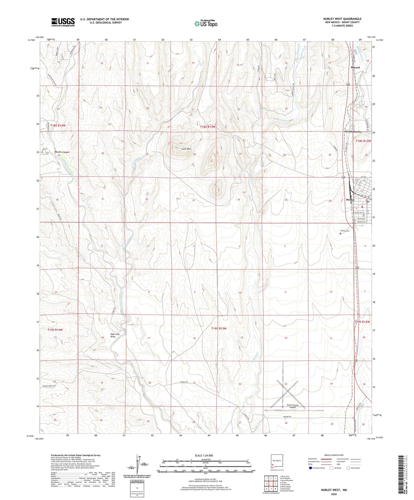
2023 topographic map quadrangle Hurley West in the state of New Mexico. Scale: 1:24000. Based on the newly updated USGS 7.5' US Topo map series, this map is in the following counties: Grant. The map contains contour data, water features, and other items you are used to seeing on USGS maps, but also has updated roads and other features. This is the next generation of topographic maps. Printed on high-quality waterproof paper with UV fade-resistant inks.
Quads adjacent to this one:
West: Tyrone
Northwest: Silver City
North: Fort Bayard
Northeast: Santa Rita Mine
East: Hurley East
Southeast: Faywood Station
South: Whitewater
Southwest: White Signal
This map covers the same area as the classic USGS quad with code o32108f2.
Contains the following named places: 00335 Water Well, 00340 Water Well, 00345 Water Well, 00407 Water Well, 00411 Water Well, 00412 Water Well, 00414 Water Well, 00449 Water Well, 00734 Water Well, 00736 Water Well, 00759 Water Well, 00775 Water Well, 00791 Water Well, 10024 Water Well, 10029 Water Well, 10030 Water Well, 88023, Apache Tejo, Ben Hur Mine, Eighty Four Mine, G 773 Water Well, G 778 Water Well, G 790 Water Well, Grant County Airport, Home Ticket Mine, Hurley, Hurley Cemetery, Hurley Elementary School, Hurley Fire Department, Hurley Police Department, Hurley Post Office, Infant Jesus Parish, Joe Mine, Lone Mountain, Maudes Canyon, Monarch Mine, New York Mine, Newton, North Hurley, North Hurley Census Designated Place, Pipe Line Draw, Rio de Arenas, San Vincente, Sweet Home Mine, Town of Hurley, Twin Sisters Creek