
MyTopo
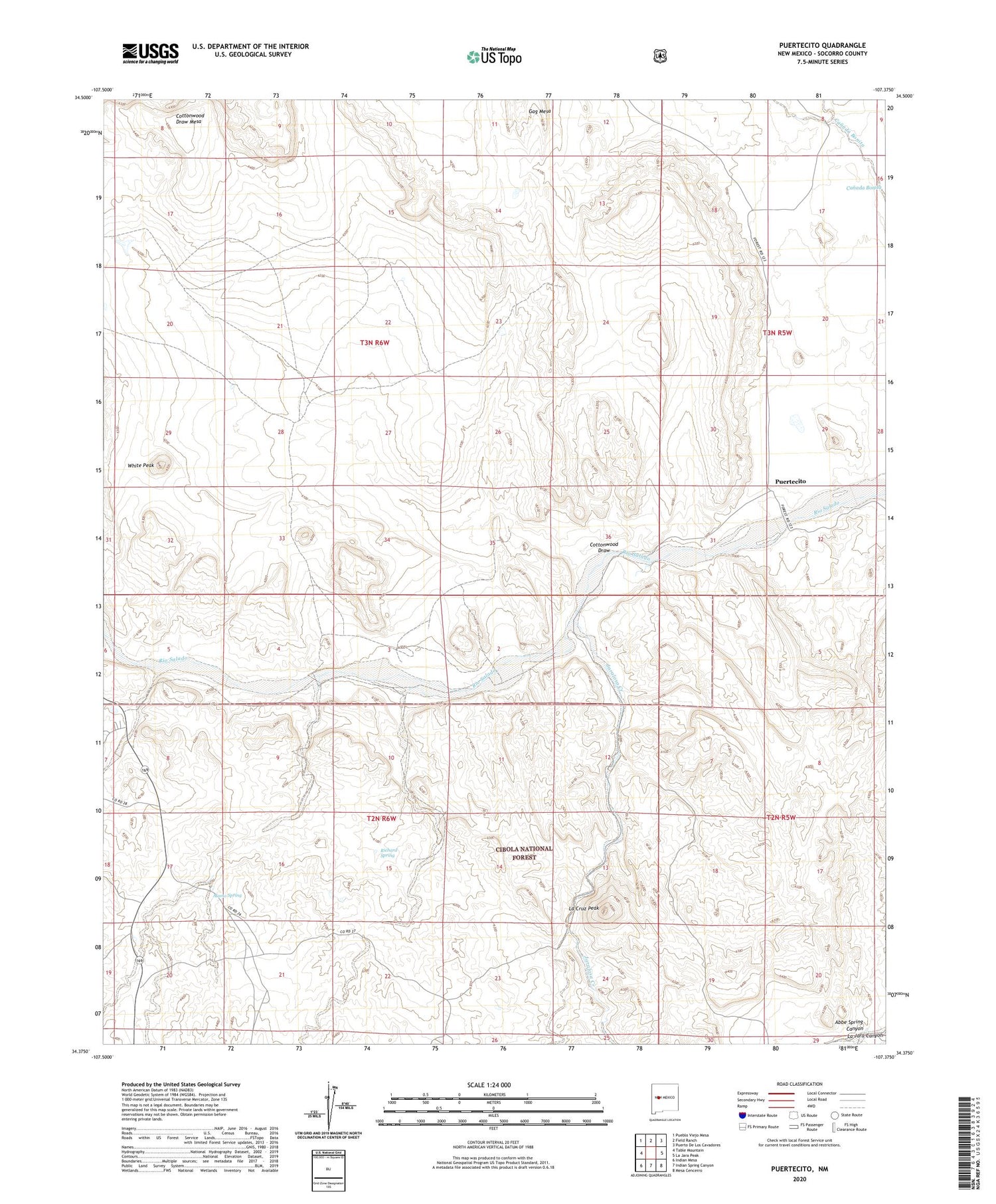
Puertecito New Mexico US Topo Map
Couldn't load pickup availability
Also explore the Puertecito Forest Service Topo of this same quad for updated USFS data
2023 topographic map quadrangle Puertecito in the state of New Mexico. Scale: 1:24000. Based on the newly updated USGS 7.5' US Topo map series, this map is in the following counties: Socorro. The map contains contour data, water features, and other items you are used to seeing on USGS maps, but also has updated roads and other features. This is the next generation of topographic maps. Printed on high-quality waterproof paper with UV fade-resistant inks.
Quads adjacent to this one:
West: Table Mountain
Northwest: Pueblo Viejo Mesa
North: Field Ranch
Northeast: Puerto De Los Cavadores
East: La Jara Peak
Southeast: Mesa Cencerro
South: Indian Spring Canyon
Southwest: Indian Mesa
This map covers the same area as the classic USGS quad with code o34107d4.
Contains the following named places: Abbe Spring Canyon, Alamo Creek, Alamo Navajo Emergency Medical Services, Alamo Navajo Reservation, Alamo Spring, Apache Well, Bill Dobbs Well, Chavez Creek, Chavez Ranch, Cottonwood Draw, Cottonwood Draw Mesa, Jaralosa Creek, John Padilla Settlement, La Cruz Peak, Navajo Community Hall, Puertecito, Puertecito Post Office, Richard Spring, White Peak


