MyTopo
Jicarita Peak New Mexico US Topo Map
Couldn't load pickup availability
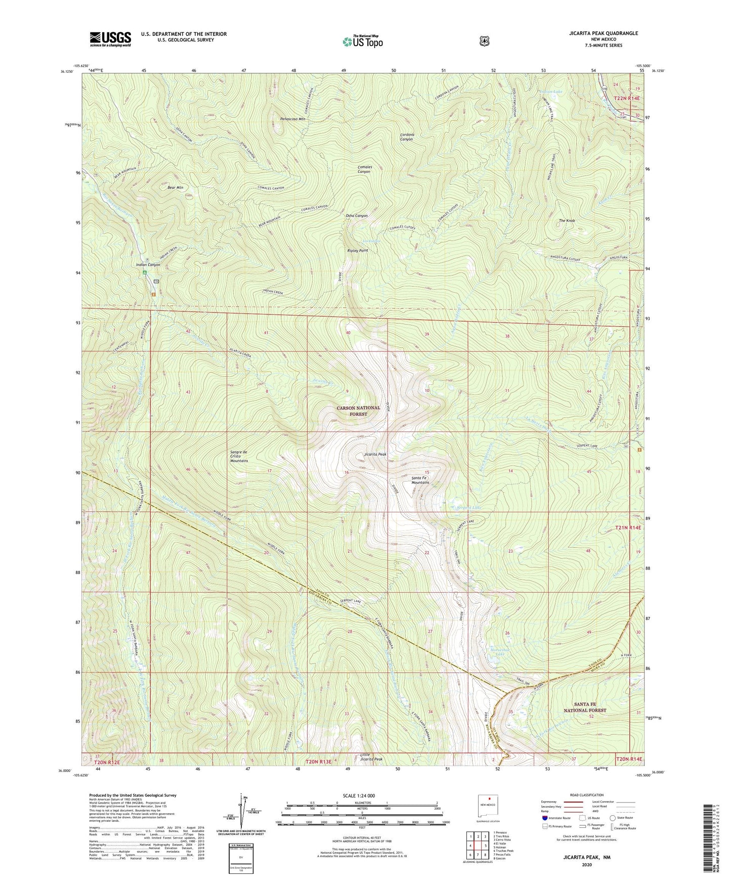
2020 topographic map quadrangle Jicarita Peak in the state of New Mexico. Scale: 1:24000. Based on the newly updated USGS 7.5' US Topo map series, this map is in the following counties: Taos, Rio Arriba, Mora. The map contains contour data, water features, and other items you are used to seeing on USGS maps, but also has updated roads and other features. This is the next generation of topographic maps. Printed on high-quality waterproof paper with UV fade-resistant inks.
Quads adjacent to this one:
West: El Valle
Northwest: Penasco
North: Tres Ritos
Northeast: Cerro Vista
East: Holman
Southeast: Gascon
South: Pecos Falls
Southwest: Truchas Peak
Contains the following named places: Bear Mountain, Comales Trail, Divide Trail, East Fork Rio Santa Barbara, Horseshoe Lake, Indian Canyon, Indian Lake, Jicarita Creek, Jicarita Peak, Los Esteros, Middle Fork Rio Santa Barbara, North Fork Lake, Osha Trail, Penascoso Mountain, Ripley Point, Santa Barbara Angostura Trail, Santa Barbara Campground, Santa Barbara Forest Service Cabin, Serpent Lake, The Knob, West Fork Angostura Trail, West Fork Rio Santa Barbara, ZIP Codes: 87521, 87579