MyTopo
Collins Park New Mexico US Topo Map
Couldn't load pickup availability
Also explore the Collins Park Forest Service Topo of this same quad for updated USFS data
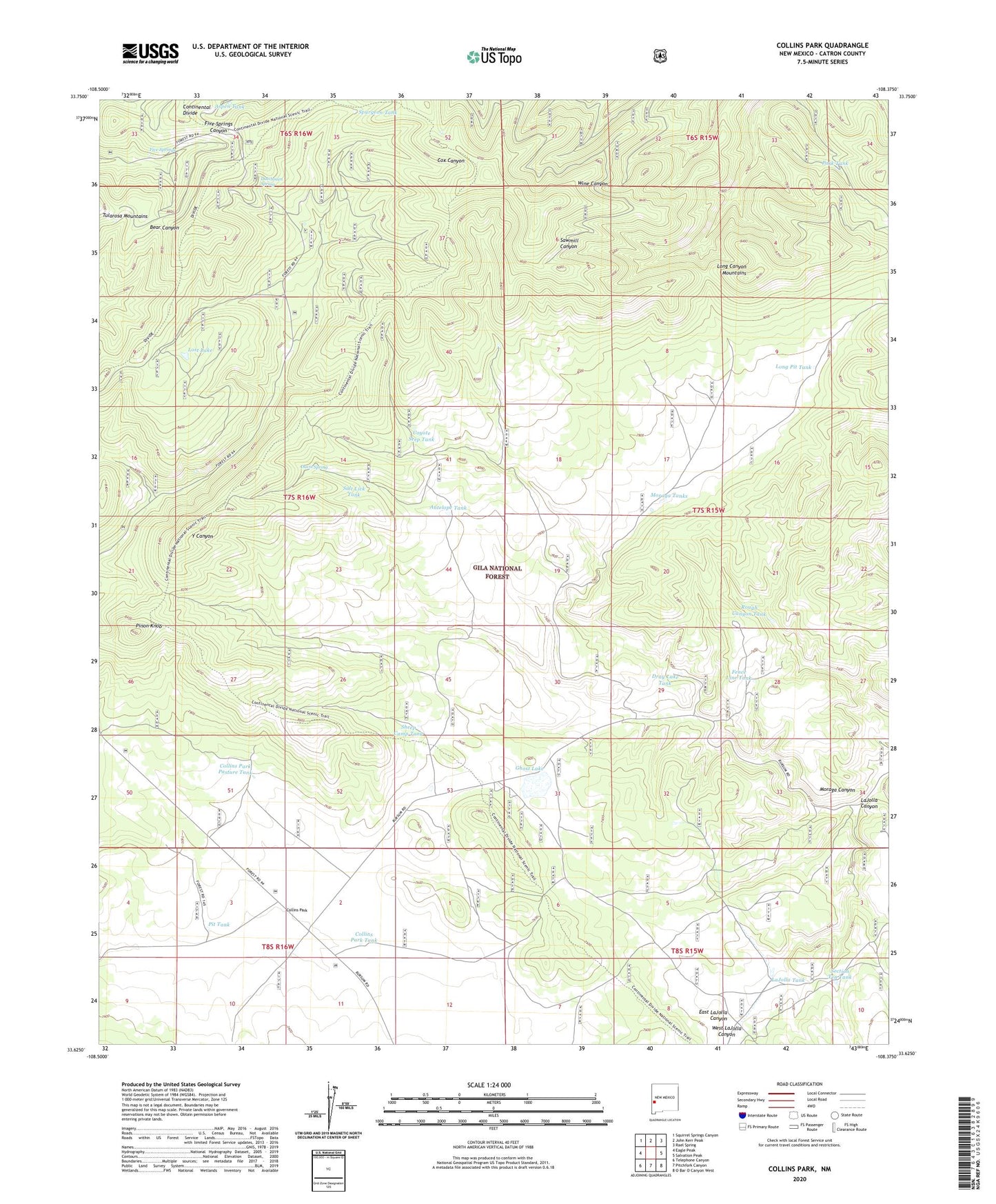
2023 topographic map quadrangle Collins Park in the state of New Mexico. Scale: 1:24000. Based on the newly updated USGS 7.5' US Topo map series, this map is in the following counties: Catron. The map contains contour data, water features, and other items you are used to seeing on USGS maps, but also has updated roads and other features. This is the next generation of topographic maps. Printed on high-quality waterproof paper with UV fade-resistant inks.
Quads adjacent to this one:
West: Eagle Peak
Northwest: Squirrel Springs Canyon
North: John Kerr Peak
Northeast: Rael Spring
East: Salvation Peak
Southeast: O Bar O Canyon West
South: Pitchfork Canyon
Southwest: Telephone Canyon
This map covers the same area as the classic USGS quad with code o33108f4.
Contains the following named places: Antelope Tank, Aspen Tank, Collins Park, Collins Park Pasture Tank, Collins Park Tank, Collins Park Well, Coyote Seep Tank, Davis Spring, Dray Lake Tank, Dutchman Spring, Dutchman Tank, East LaJolla Canyon, Fence Line Tank, Five Springs, Ghost Lake, LaJolla Canyon, LaJolla Tank, Long Canyon Mountains, Long Pit Tank, Lost Lake, Moraga Canyon, Moraga Tanks, Park Tank, Pinon Knob, Pinon Tank, Pit Tank, Rough Canyon Tank, Salt Lick Tank, Section Ten Tank, Sheep Camp Tank, Spurgeon Tank, West LaJolla Canyon