MyTopo
Eagle Peak New Mexico US Topo Map
Couldn't load pickup availability
Also explore the Eagle Peak Forest Service Topo of this same quad for updated USFS data
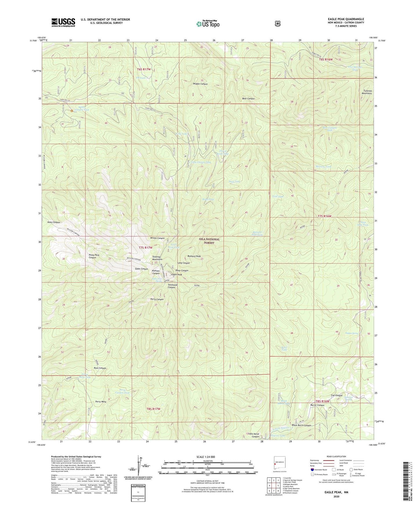
2023 topographic map quadrangle Eagle Peak in the state of New Mexico. Scale: 1:24000. Based on the newly updated USGS 7.5' US Topo map series, this map is in the following counties: Catron. The map contains contour data, water features, and other items you are used to seeing on USGS maps, but also has updated roads and other features. This is the next generation of topographic maps. Printed on high-quality waterproof paper with UV fade-resistant inks.
Quads adjacent to this one:
West: Milligan Mountain
Northwest: Cruzville
North: Squirrel Springs Canyon
Northeast: John Kerr Peak
East: Collins Park
Southeast: Pitchfork Canyon
South: Telephone Canyon
Southwest: Sign Camp Mountain
This map covers the same area as the classic USGS quad with code o33108f5.
Contains the following named places: Barrel Canyon, Bear Canyon, Bear Canyon Tank, Black Burro Canyon, Black Burro Tank, Black Horse Canyon, Buzzard Peak, Buzzard Peak Tank, Cox Canyon, Deadman Spring, Deep Tank, Eagle Peak, Eagle Peak Spring, Eagle Peak Tank, End of Road Tank, FD Tank, Five Springs Tank, Fork Tank, Hidden Spring, Long Canyon Tank, McCarty Tank, Miner Tank, Negrito Tank, Perry Canyon Tank, Perry Mesa, Perry Mesa Tank, Reserve Ranger District, Road Tank, Rock Tank, Sheep Seep Tank, Trial Tank, Trujillo Tank, Wilson Canyon Tank