MyTopo
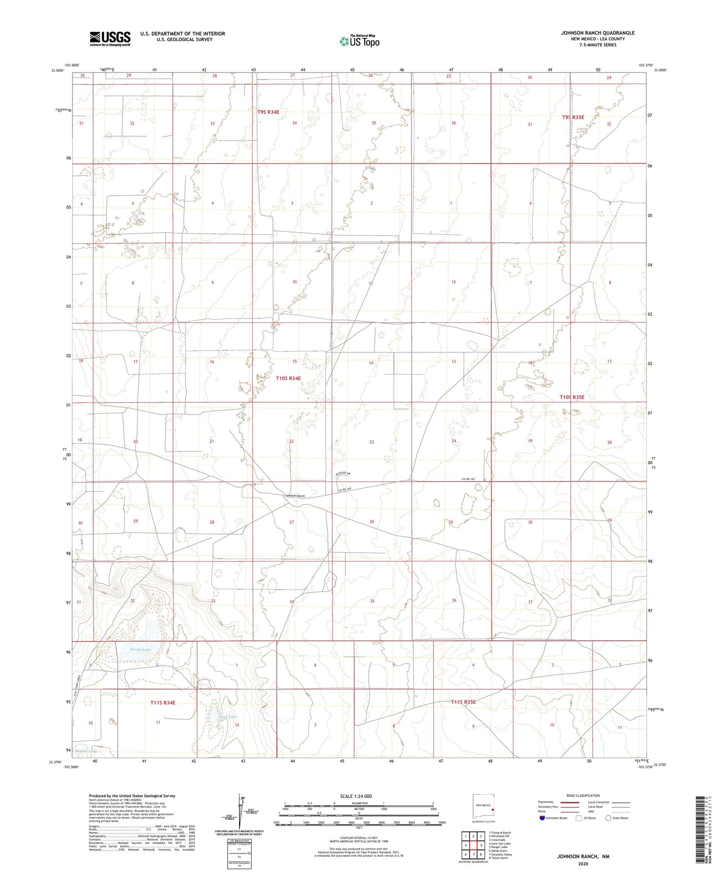
Johnson Ranch New Mexico US Topo Map
Couldn't load pickup availability
2023 topographic map quadrangle Johnson Ranch in the state of New Mexico. Scale: 1:24000. Based on the newly updated USGS 7.5' US Topo map series, this map is in the following counties: Lea. The map contains contour data, water features, and other items you are used to seeing on USGS maps, but also has updated roads and other features. This is the next generation of topographic maps. Printed on high-quality waterproof paper with UV fade-resistant inks.
Quads adjacent to this one:
West: Lane Salt Lake
Northwest: Flying M Ranch
North: Milnesand SW
Northeast: Crossroads
East: Ranger Lake
Southeast: Tatum North
South: Simanola Valley
Southwest: Dallas Store
This map covers the same area as the classic USGS quad with code o33103d4.
Contains the following named places: 05001 Water Well, 05017 Water Well, 05018 Water Well, 12598 Water Well, 12599 Water Well, 12600 Water Well, 12607 Water Well, 12608 Water Well, 12866 Water Well, 13385 Water Well, 13388 Water Well, Double Windmill, Drill Hole Sand Windmill, East Lake, Jog Windmill, Johnson Ranch, Lucky Windmill, North Lake, North Windmill, Number One Windmill, Number Three Windmill, Number Two Windmill, South Windmill, X Four Windmill