MyTopo
Taylor Ranch New Mexico US Topo Map
Couldn't load pickup availability
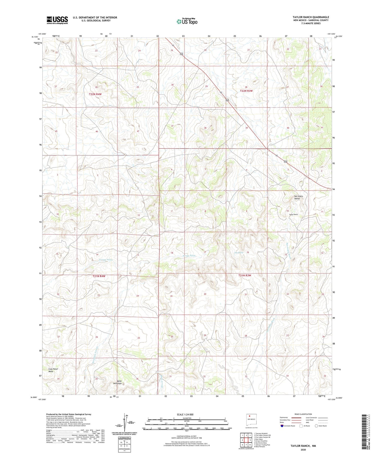
2023 topographic map quadrangle Taylor Ranch in the state of New Mexico. Scale: 1:24000. Based on the newly updated USGS 7.5' US Topo map series, this map is in the following counties: Sandoval. The map contains contour data, water features, and other items you are used to seeing on USGS maps, but also has updated roads and other features. This is the next generation of topographic maps. Printed on high-quality waterproof paper with UV fade-resistant inks.
Quads adjacent to this one:
West: Deer Mesa
Northwest: Tancosa Windmill
North: Five Lakes Canyon NW
Northeast: Five Lakes Canyon NE
East: Arroyo Chijuillita
Southeast: Mesa Portales
South: Johnson Trading Post
Southwest: Ojo Encino Mesa
This map covers the same area as the classic USGS quad with code o36107a2.
Contains the following named places: Alexander Ranch, Ceja Pelon Mesa, Crook Number Two Group, Dry Spring, Encino Detention Dam Number 63, Landers, Mesa Penistaja, Taylor, Taylor Ranch, Wood, Wood Ranch