MyTopo
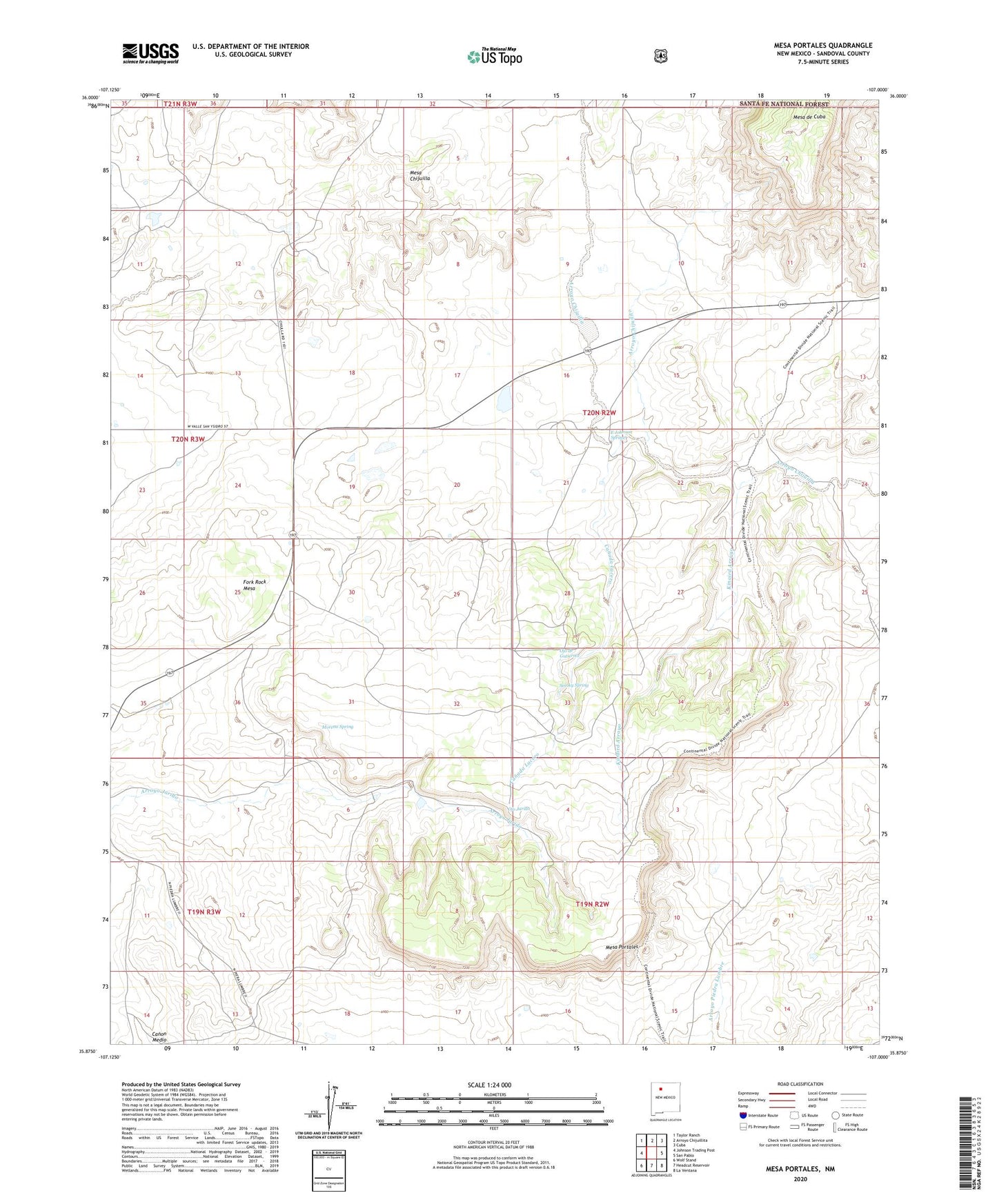
Mesa Portales New Mexico US Topo Map
Couldn't load pickup availability
Also explore the Mesa Portales Forest Service Topo of this same quad for updated USFS data
2023 topographic map quadrangle Mesa Portales in the state of New Mexico. Scale: 1:24000. Based on the newly updated USGS 7.5' US Topo map series, this map is in the following counties: Sandoval. The map contains contour data, water features, and other items you are used to seeing on USGS maps, but also has updated roads and other features. This is the next generation of topographic maps. Printed on high-quality waterproof paper with UV fade-resistant inks.
Quads adjacent to this one:
West: Johnson Trading Post
Northwest: Taylor Ranch
North: Arroyo Chijuillita
Northeast: Cuba
East: San Pablo
Southeast: La Ventana
South: Headcut Reservoir
Southwest: Wolf Stand
This map covers the same area as the classic USGS quad with code o35107h1.
Contains the following named places: Arroyo Chijuilito, Canada Lucero, Canon Jarido, E Johnson Spring, Encino Detention Dam Number 31, Encino Detention Dam Number 46, Encino Detention Dam Number 49, Fork Rock Mesa, Houston Prospect, Johnson, Kinaird Arroyo, Mesa de Cuba, Mesa Portales, Moreno Spring, Ojo de Gutierrez, Ojo Jarido, Smoky Spring