MyTopo
Arroyo Chijuillita New Mexico US Topo Map
Couldn't load pickup availability
Also explore the Arroyo Chijuillita Forest Service Topo of this same quad for updated USFS data
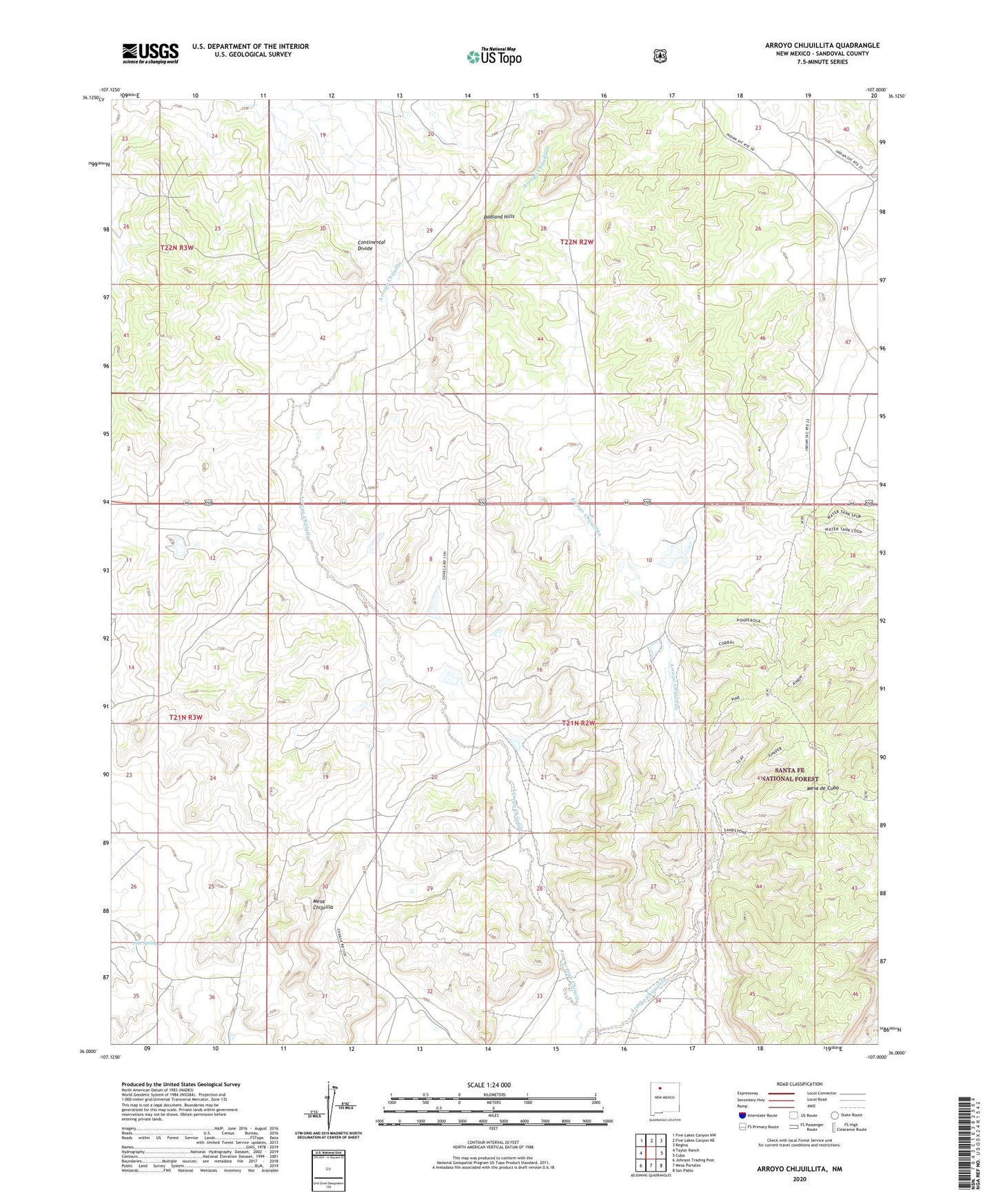
2023 topographic map quadrangle Arroyo Chijuillita in the state of New Mexico. Scale: 1:24000. Based on the newly updated USGS 7.5' US Topo map series, this map is in the following counties: Sandoval. The map contains contour data, water features, and other items you are used to seeing on USGS maps, but also has updated roads and other features. This is the next generation of topographic maps. Printed on high-quality waterproof paper with UV fade-resistant inks.
Quads adjacent to this one:
West: Taylor Ranch
Northwest: Five Lakes Canyon NW
North: Five Lakes Canyon NE
Northeast: Regina
East: Cuba
Southeast: San Pablo
South: Mesa Portales
Southwest: Johnson Trading Post
This map covers the same area as the classic USGS quad with code o36107a1.
Contains the following named places: Arroyo Chijuillita, Champe Tank, Cuba Landing Strip, Mesa Chijuilla, Pine Spring, Retention Dam Number 11, Retention Dam Number 13, Retention Dam Number 131, Retention Dam Number 132, Retention Dam Number 133, Retention Dam Number 134, Retention Dam Number 4, Retention Dam Number 7, Retention Dam Number 8, Retention Dam Number 9, Rio Puerco Detention Dam Number Eight, Rio Puerco Detention Dam Number Four, Rio Puerco Detention Dam Number Seven