MyTopo
Kansas Valley Lake New Mexico US Topo Map
Couldn't load pickup availability
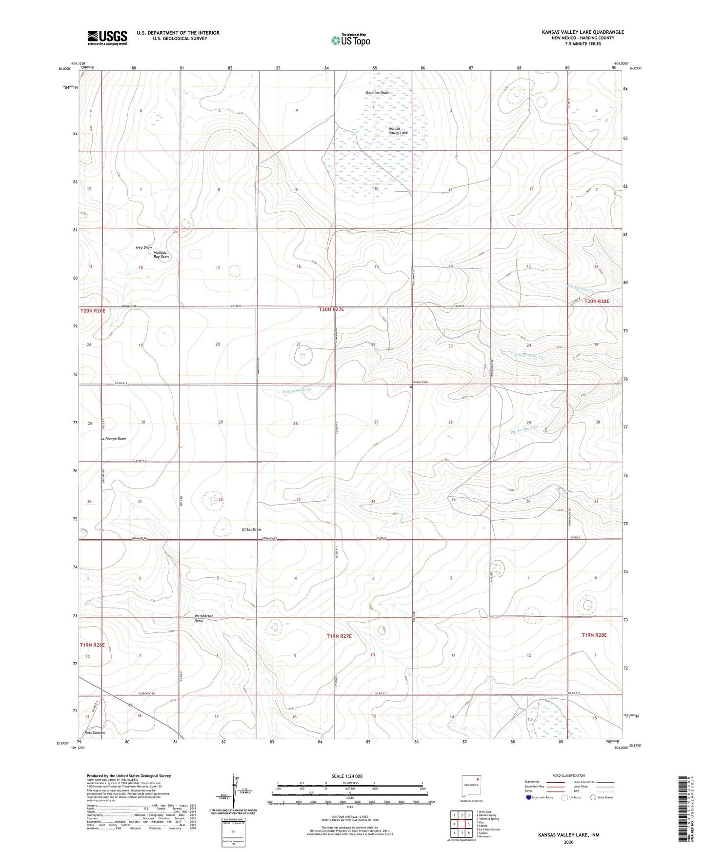
2023 topographic map quadrangle Kansas Valley Lake in the state of New Mexico. Scale: 1:24000. Based on the newly updated USGS 7.5' US Topo map series, this map is in the following counties: Harding. The map contains contour data, water features, and other items you are used to seeing on USGS maps, but also has updated roads and other features. This is the next generation of topographic maps. Printed on high-quality waterproof paper with UV fade-resistant inks.
Quads adjacent to this one:
West: Roy
Northwest: Mills East
North: Kansas Valley
Northeast: Valencia Spring
East: Sabino
Southeast: Mosquero
South: Solano
Southwest: La Cinta Canyon
This map covers the same area as the classic USGS quad with code o35104h1.
Contains the following named places: Alexander, Bouleware, Hicks, Ivey Draw, Johnson Cemetery, Kansas Valley Lake, Lake Windmill, Matilda Roy Draw, North Harding Division, Reunion Draw, Starvation Windmill, Weisdorfer Draw, ZIP Code: 87743