MyTopo
La Gotera New Mexico US Topo Map
Couldn't load pickup availability
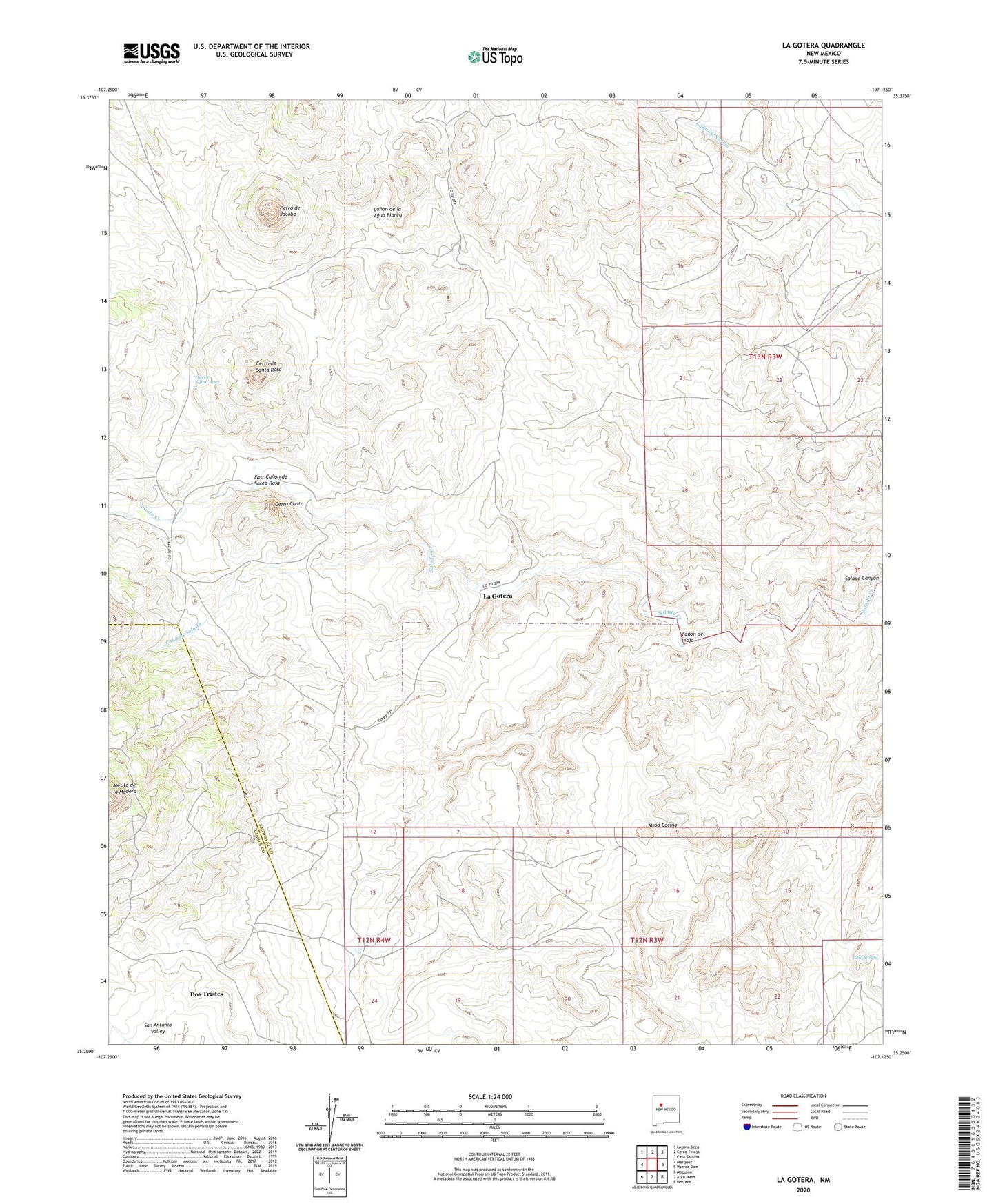
2020 topographic map quadrangle La Gotera in the state of New Mexico. Scale: 1:24000. Based on the newly updated USGS 7.5' US Topo map series, this map is in the following counties: Sandoval, Cibola. The map contains contour data, water features, and other items you are used to seeing on USGS maps, but also has updated roads and other features. This is the next generation of topographic maps. Printed on high-quality waterproof paper with UV fade-resistant inks.
Quads adjacent to this one:
West: Marquez
Northwest: Laguna Seca
North: Cerro Tinaja
Northeast: Casa Salazar
East: Puerco Dam
Southeast: Herrera
South: Arch Mesa
Southwest: Moquino
Contains the following named places: Agua Blanca Well, Agua Salada Grant, B and G Prospect, Betty Mine, Brookhaven Prospect, Canada Salada, Canon de la Agua Blanca, Canon del Piojo, Cerro Chato, Cerro de Jacobo, Cerro de Santa Rosa, Dogs Water Well, Dorey Mine, Dos Tristes, East Canon de Santa Rosa, Evans Ranch, La Gotera, Mesa Cocina, Mesita de la Madera, Nuestra Senora de la Luz de las Lagunitas Grant, Ojo De Santa Rosa, Pino Spring, Rancho Agua Blanca, San Antonio Valley, San Antonio Water Well