MyTopo
Laguna Seca New Mexico US Topo Map
Couldn't load pickup availability
Also explore the Laguna Seca Forest Service Topo of this same quad for updated USFS data
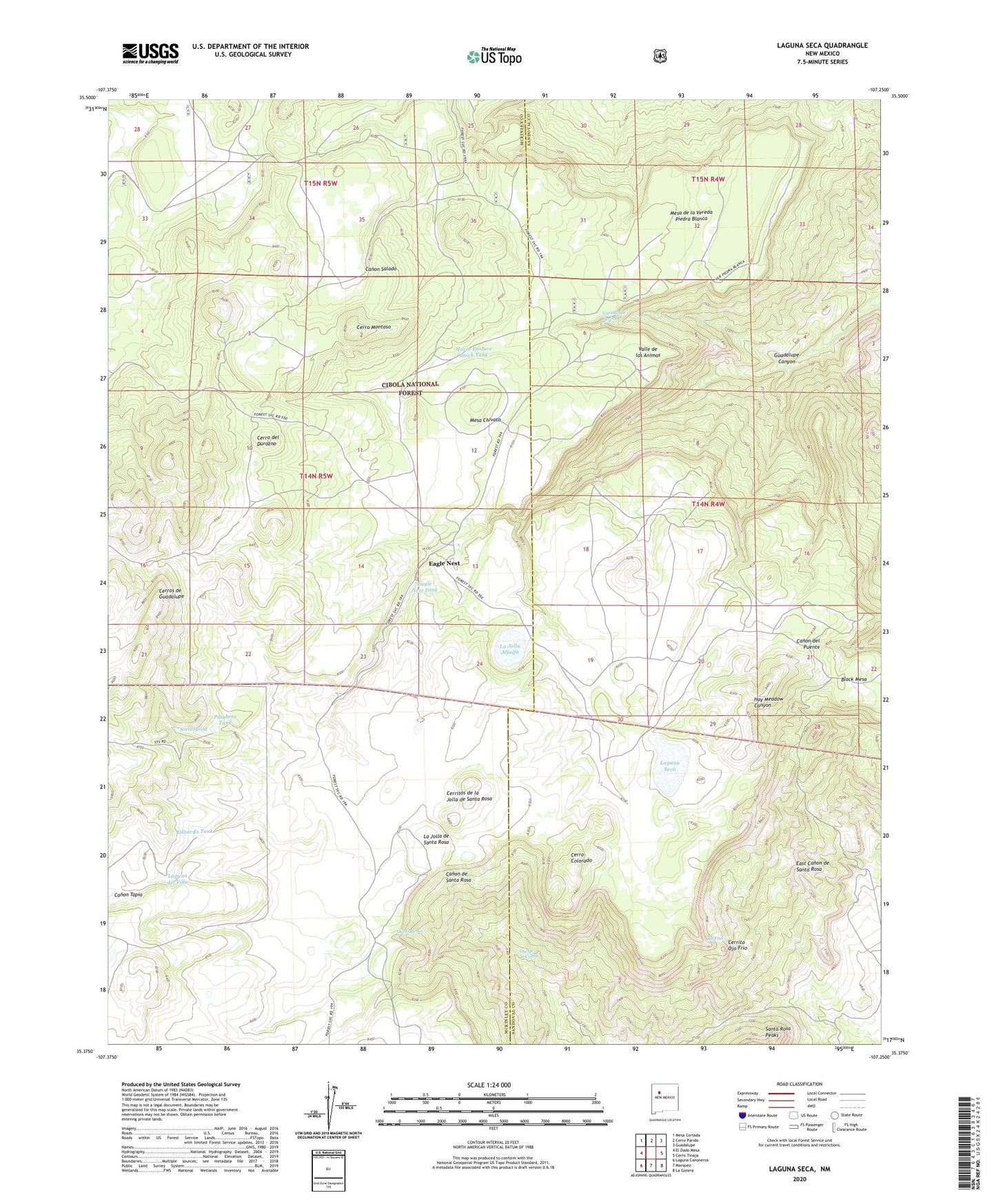
2023 topographic map quadrangle Laguna Seca in the state of New Mexico. Scale: 1:24000. Based on the newly updated USGS 7.5' US Topo map series, this map is in the following counties: McKinley, Sandoval. The map contains contour data, water features, and other items you are used to seeing on USGS maps, but also has updated roads and other features. This is the next generation of topographic maps. Printed on high-quality waterproof paper with UV fade-resistant inks.
Quads adjacent to this one:
West: El Dado Mesa
Northwest: Mesa Cortada
North: Cerro Parido
Northeast: Guadalupe
East: Cerro Tinaja
Southeast: La Gotera
South: Marquez
Southwest: Laguna Canoneros
This map covers the same area as the classic USGS quad with code o35107d3.
Contains the following named places: Black Mesa, Cerrito Ojo Frio, Cerritos de la Jolla de Santa Rosa, Cerro Colorado, Cerro del Durazno, Cerro Montoso, Cerros de Guadalupe, Eagle Nest, Eagle Nest Tank, Eduardo Tank, Escondido Tank, Evans Well, Guadalupe Canyon, Guadalupe Ranger Station, Guadalupe Spring, Guadalupe Tank, Horse Pasture Stock Tank, La Jolla Alfalfa, La Jolla de Santa Rosa, Laguna del Vino, Laguna Seca, Mariposa Tank, Marquez Wildlife Area, Mesa de la Vereda Piedra Blanca, North Spring, Ojo de la Cobra, Ojo Eugenio, Ojo Frio, Piedra Blanca Tank, Pinabeta Tank, Valle de las Animas