
MyTopo
Ladron Peak New Mexico US Topo Map
Couldn't load pickup availability
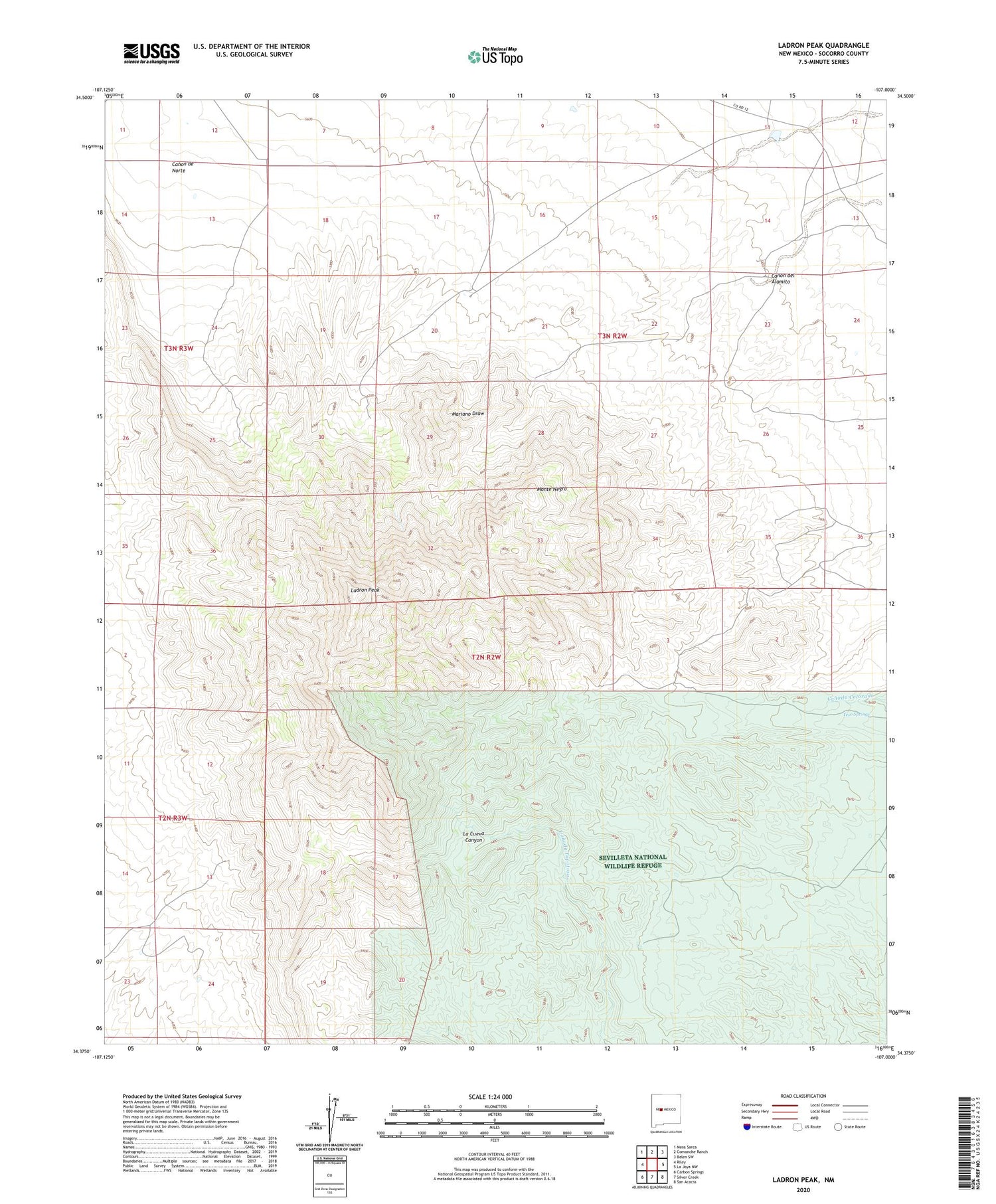
2023 topographic map quadrangle Ladron Peak in the state of New Mexico. Scale: 1:24000. Based on the newly updated USGS 7.5' US Topo map series, this map is in the following counties: Socorro. The map contains contour data, water features, and other items you are used to seeing on USGS maps, but also has updated roads and other features. This is the next generation of topographic maps. Printed on high-quality waterproof paper with UV fade-resistant inks.
Quads adjacent to this one:
West: Riley
Northwest: Mesa Sarca
North: Comanche Ranch
Northeast: Belen SW
East: La Joya NW
Southeast: San Acacia
South: Silver Creek
Southwest: Carbon Springs
This map covers the same area as the classic USGS quad with code o34107d1.
Contains the following named places: Canada Colorado, Canon de Norte, Canon del Alamito, Jeter Prospect, KMXQ-FM (Socorro), Ladron Peak, Lazy C Bar J Ranch, Monte Negro, Rule, Sierra Ladrones Wilderness Study Area, Yeso Springs


