MyTopo
Mesa Sarca New Mexico US Topo Map
Couldn't load pickup availability
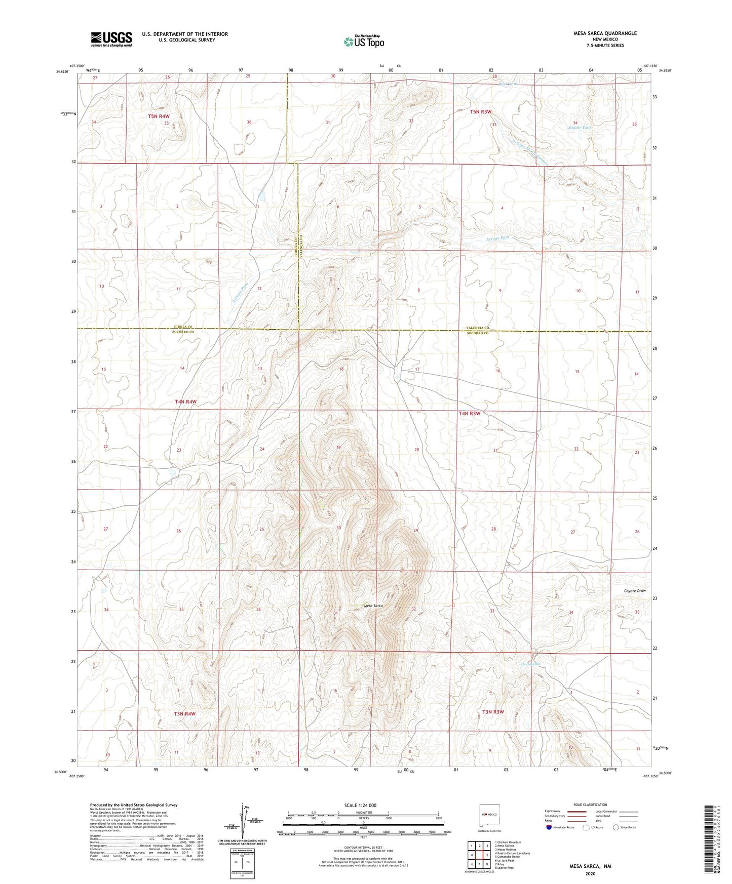
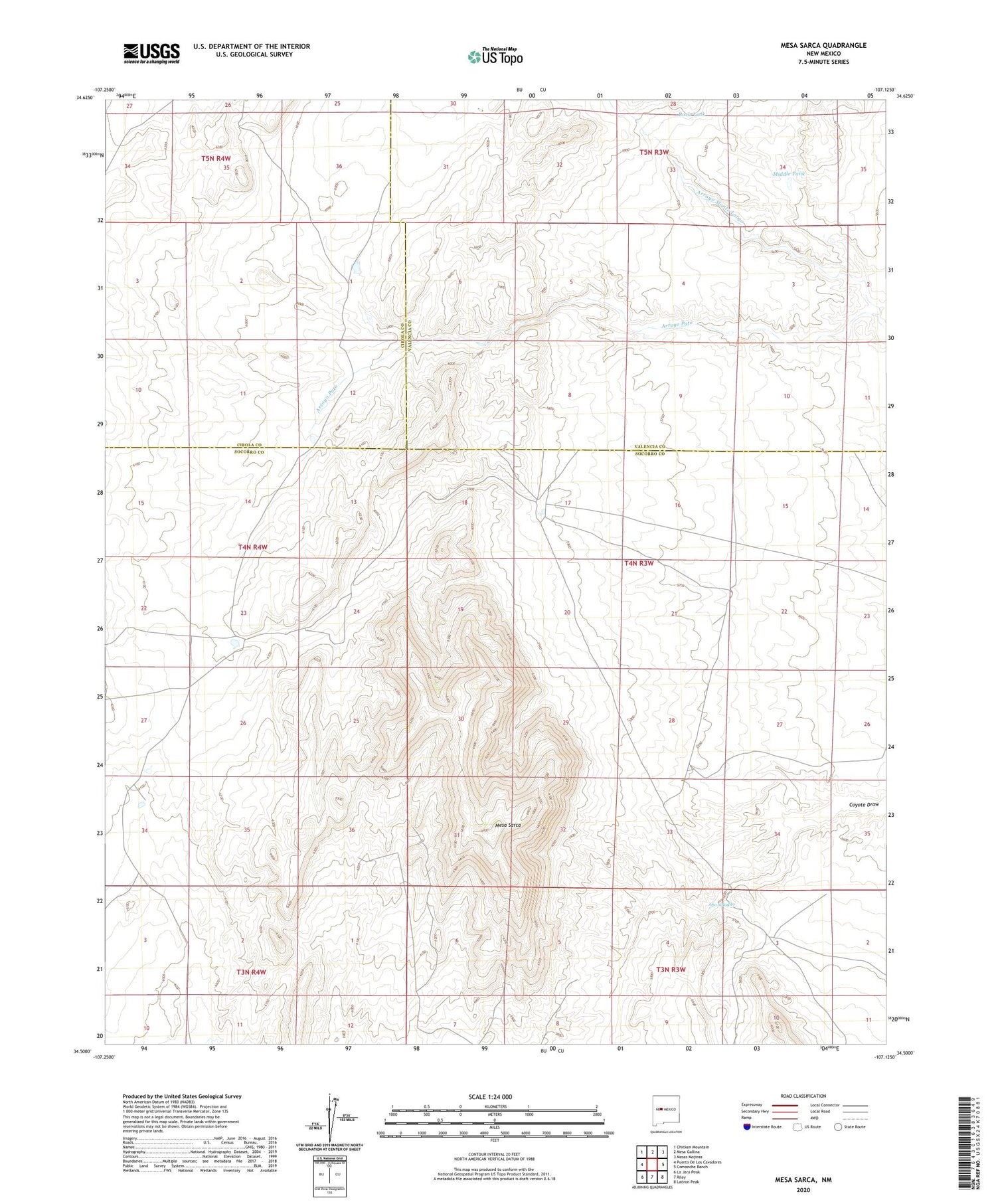
2023 topographic map quadrangle Mesa Sarca in the state of New Mexico. Scale: 1:24000. Based on the newly updated USGS 7.5' US Topo map series, this map is in the following counties: Socorro, Valencia, Cibola. The map contains contour data, water features, and other items you are used to seeing on USGS maps, but also has updated roads and other features. This is the next generation of topographic maps. Printed on high-quality waterproof paper with UV fade-resistant inks.
Quads adjacent to this one:
West: Puerto De Los Cavadores
Northwest: Chicken Mountain
North: Mesa Gallina
Northeast: Mesas Mojinas
East: Comanche Ranch
Southeast: Ladron Peak
South: Riley
Southwest: La Jara Peak
This map covers the same area as the classic USGS quad with code o34107e2.
Contains the following named places: Drake, Mesa Sarca, Middle Tank, Ojo Saladito, Rock Tank, Saladito Ranch