MyTopo
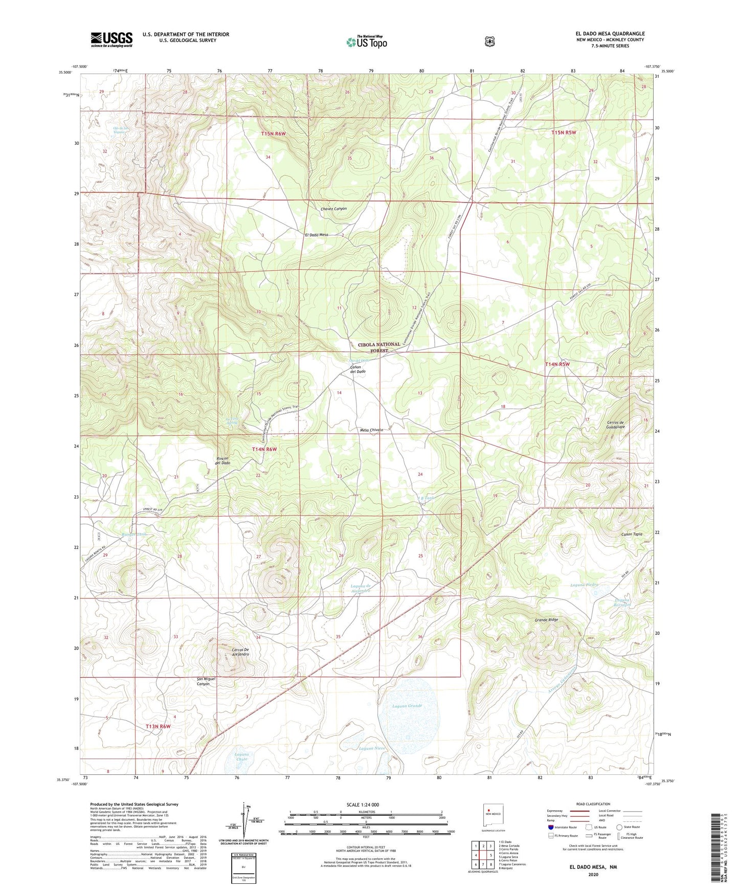
El Dado Mesa New Mexico US Topo Map
Couldn't load pickup availability
Also explore the El Dado Mesa Forest Service Topo of this same quad for updated USFS data
2023 topographic map quadrangle El Dado Mesa in the state of New Mexico. Scale: 1:24000. Based on the newly updated USGS 7.5' US Topo map series, this map is in the following counties: McKinley. The map contains contour data, water features, and other items you are used to seeing on USGS maps, but also has updated roads and other features. This is the next generation of topographic maps. Printed on high-quality waterproof paper with UV fade-resistant inks.
Quads adjacent to this one:
West: Cerro Alesna
Northwest: El Dado
North: Mesa Cortada
Northeast: Cerro Parido
East: Laguna Seca
Southeast: Marquez
South: Laguna Canoneros
Southwest: Cerro Pelon
This map covers the same area as the classic USGS quad with code o35107d4.
Contains the following named places: Alejandro Water Tank, Cerros De Alejandro, ED-7 Water Well, El Dado Mesa, Fishback Dam, Grande Camp, Grande Ridge, Heller Tank, J B Tank, La Vera Spring, Laguna Blanca, Laguna Borregos, Laguna Chute, Laguna de Alejandro, Laguna de Cosme, Laguna del Cerro, Laguna del Cerro Rojo, Laguna Grande, Laguna Nieve, Laguna Piedra, Laguna Pino, Ojo de las Yeguas, Ojo del Dado, Pine Grove Tank, Ranger Tank