MyTopo
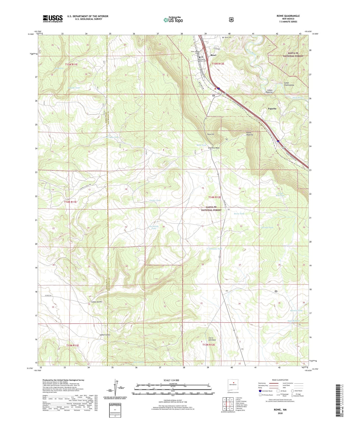
Rowe New Mexico US Topo Map
Couldn't load pickup availability
Also explore the Rowe Forest Service Topo of this same quad for updated USFS data
2023 topographic map quadrangle Rowe in the state of New Mexico. Scale: 1:24000. Based on the newly updated USGS 7.5' US Topo map series, this map is in the following counties: San Miguel, Santa Fe. The map contains contour data, water features, and other items you are used to seeing on USGS maps, but also has updated roads and other features. This is the next generation of topographic maps. Printed on high-quality waterproof paper with UV fade-resistant inks.
Quads adjacent to this one:
West: Bull Canyon
Northwest: Glorieta
North: Pecos
Northeast: Lower Colonias
East: North San Ysidro
Southeast: Laguna Ortiz
South: Rencona
Southwest: Wildhorse Mesa
This map covers the same area as the classic USGS quad with code o35105d6.
Contains the following named places: Agua Bendita, Archuleta Ranch, Barbero Tank, Barbero Well, Bobcat Spring, Canada Tank, Canon Ancho, Canon Cedro, Canon Chamisolosa, Canon Pajarita, Cerro Encinoso, Corner Tank, Divided Tank, Gonzales Tank, Holy Family Catholic Cemetery, Horse Tank, Jim Dandy Tank, Los Trigos, Lost Tank, Mesa Tank, No Agua Tank, North Rim Tank, Ortiz Spring, Ortiz Well, Pajarita, Punta Pajarita, Rowe, Rowe Cemetery, Rowe Census Designated Place, Rowe Hill, Rowe Post Office, Saint Josephs Chapel Cemetery, San Miguel County Fire District Rowe Fire Department Station 2, Upper Barbero Tank, ZIP Code: 87562