MyTopo
Lake Armijo New Mexico US Topo Map
Couldn't load pickup availability
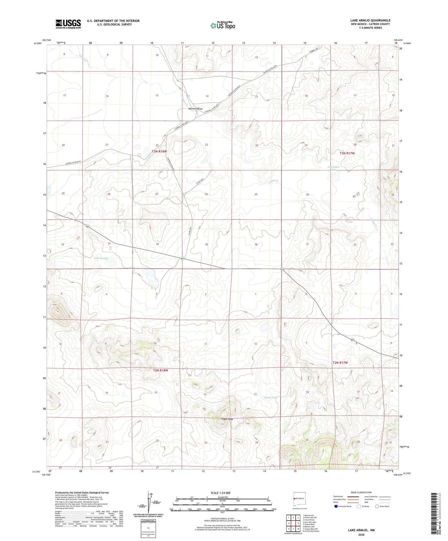
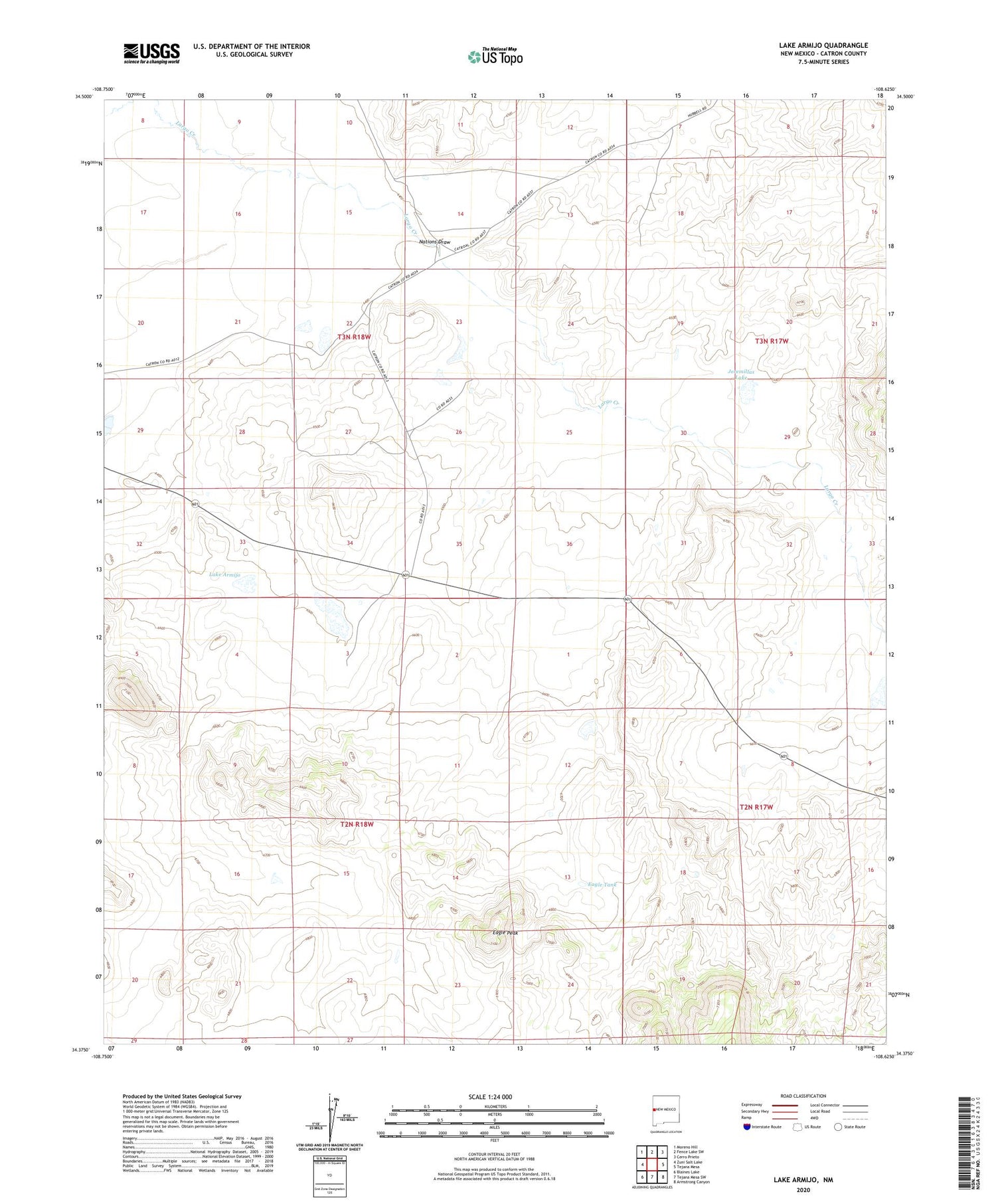
2020 topographic map quadrangle Lake Armijo in the state of New Mexico. Scale: 1:24000. Based on the newly updated USGS 7.5' US Topo map series, this map is in the following counties: Catron. The map contains contour data, water features, and other items you are used to seeing on USGS maps, but also has updated roads and other features. This is the next generation of topographic maps. Printed on high-quality waterproof paper with UV fade-resistant inks.
Quads adjacent to this one:
West: Zuni Salt Lake
Northwest: Moreno Hill
North: Fence Lake SW
Northeast: Cerro Prieto
East: Tejana Mesa
Southeast: Armstrong Canyon
South: Tejana Mesa SW
Southwest: Blaines Lake
Contains the following named places: Eagle Peak, Eagle Peak Wilderness Study Area, Eagle Tank, Finch Well, Jeremillas Lake, Jeremillas Well, Jerry Well, Lake Armijo, Lazy K Slash Well, Little Wells, Midway Well, Nations Draw, New Well, Old Rito Well, Tapia Well