MyTopo
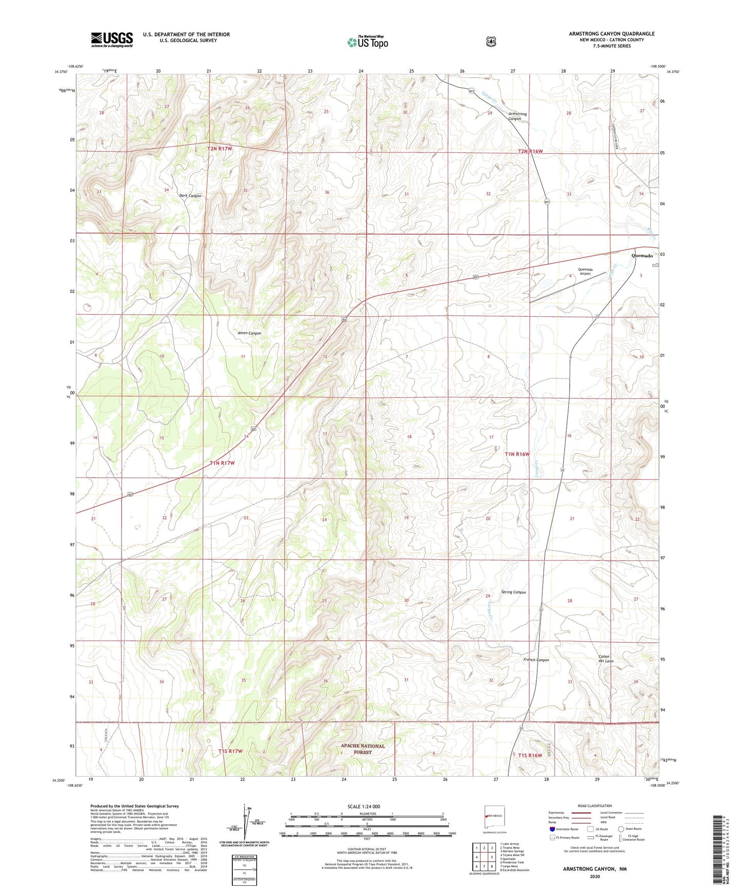
Armstrong Canyon New Mexico US Topo Map
Couldn't load pickup availability
Also explore the Armstrong Canyon Forest Service Topo of this same quad for updated USFS data
2023 topographic map quadrangle Armstrong Canyon in the state of New Mexico. Scale: 1:24000. Based on the newly updated USGS 7.5' US Topo map series, this map is in the following counties: Catron. The map contains contour data, water features, and other items you are used to seeing on USGS maps, but also has updated roads and other features. This is the next generation of topographic maps. Printed on high-quality waterproof paper with UV fade-resistant inks.
Quads adjacent to this one:
West: Tejana Mesa SW
Northwest: Lake Armijo
North: Tejana Mesa
Northeast: Mariano Springs
East: Quemado
Southeast: Escondido Mountain
South: Largo Mesa
Southwest: Ponderosa Tank
This map covers the same area as the classic USGS quad with code o34108c5.
Contains the following named places: Allison Windmill, Armstrong Canyon, Canon del Leon, Caudill Windmill, Cottonwood Windmill, French Canyon, Hay Canyon Well, Hollingsworth Windmill, Middle Windmill, North Tank, Quemado Airport, Quemado Census Designated Place, Rito Creek, Spring Canyon