MyTopo
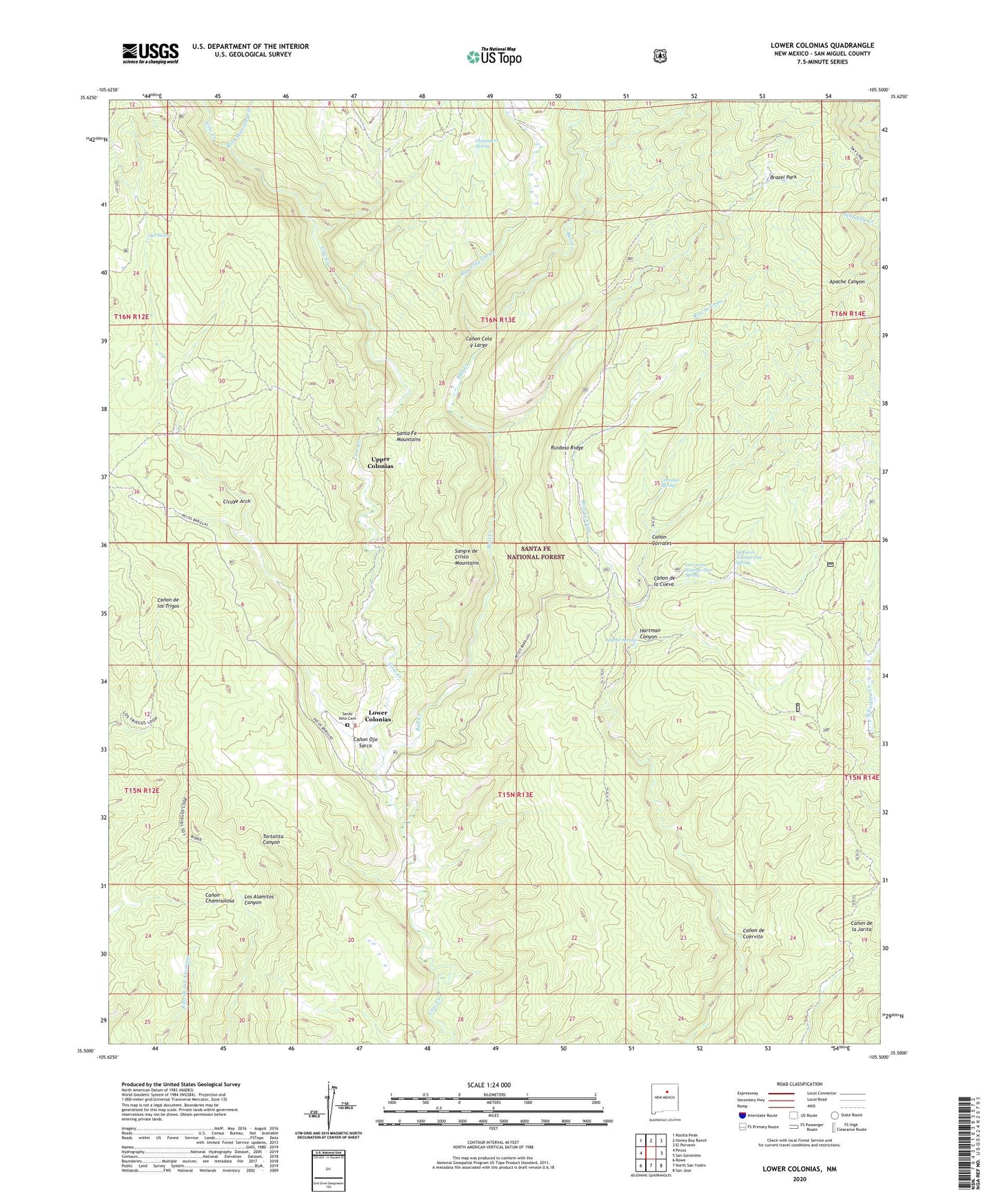
Lower Colonias New Mexico US Topo Map
Couldn't load pickup availability
Also explore the Lower Colonias Forest Service Topo of this same quad for updated USFS data
2023 topographic map quadrangle Lower Colonias in the state of New Mexico. Scale: 1:24000. Based on the newly updated USGS 7.5' US Topo map series, this map is in the following counties: San Miguel. The map contains contour data, water features, and other items you are used to seeing on USGS maps, but also has updated roads and other features. This is the next generation of topographic maps. Printed on high-quality waterproof paper with UV fade-resistant inks.
Quads adjacent to this one:
West: Pecos
Northwest: Rosilla Peak
North: Honey Boy Ranch
Northeast: El Porvenir
East: San Geronimo
Southeast: San Jose
South: North San Ysidro
Southwest: Rowe
This map covers the same area as the classic USGS quad with code o35105e5.
Contains the following named places: Apache Spring, Brazel Park, Bull Creek, Canon Cola y Largo, Canon Corrales, Canon de Cuervito, Canon de la Cueva, Canon Ojo Sarco, Chupadero Spring, Cicuye Arch, Corrales Spring, Flying Cloud Ranch, Hartman Canyon, Kay Bar Ranch, La Cueva Number Two Spring, La Cueve Number One Spring, Lower Colonias, Ojo Sarco, Pecos Division, Rito Cola Largo, Rito Cola y Largo, Rito la Vega, Rito Manzanares, Rito Ruidoso, Ruidoso Ridge, Santo Nino Cemetery, Upper Colonias