MyTopo
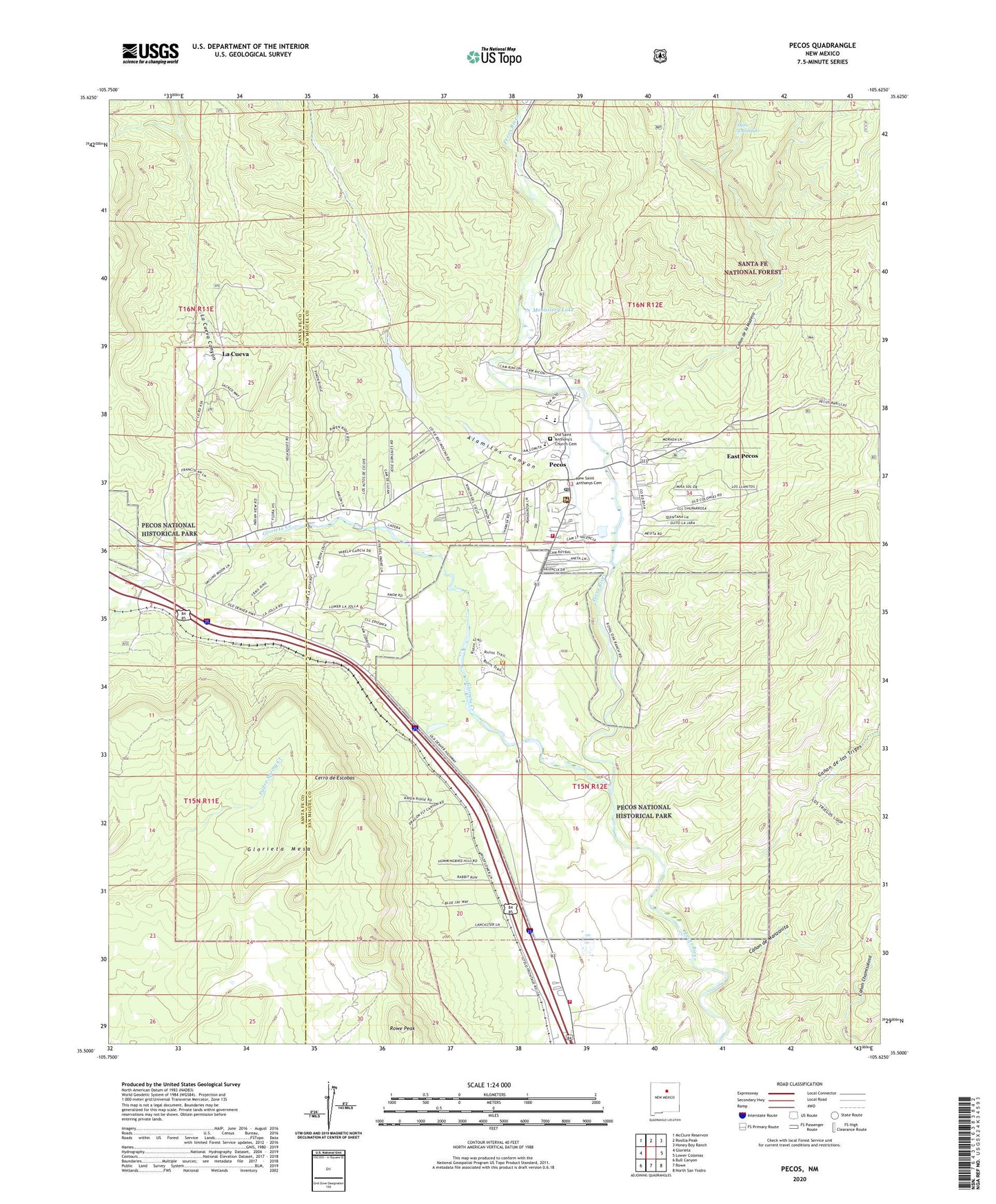
Pecos New Mexico US Topo Map
Couldn't load pickup availability
Also explore the Pecos Forest Service Topo of this same quad for updated USFS data
2023 topographic map quadrangle Pecos in the state of New Mexico. Scale: 1:24000. Based on the newly updated USGS 7.5' US Topo map series, this map is in the following counties: San Miguel, Santa Fe. The map contains contour data, water features, and other items you are used to seeing on USGS maps, but also has updated roads and other features. This is the next generation of topographic maps. Printed on high-quality waterproof paper with UV fade-resistant inks.
Quads adjacent to this one:
West: Glorieta
Northwest: McClure Reservoir
North: Rosilla Peak
Northeast: Honey Boy Ranch
East: Lower Colonias
Southeast: North San Ysidro
South: Rowe
Southwest: Bull Canyon
This map covers the same area as the classic USGS quad with code o35105e6.
Contains the following named places: Alamitos Canyon, Alexander Valle Grant, Benedictine Monastery, Canon de la Madera, Canon de los Trigos, Canon de Manzanita, Cerro de Escobas, East Pecos, East Pecos Census Designated Place, Fairview Lode Mine, Forked Lightning Ranch, Glorieta Creek, Kennedy, La Cueva, La Cueva Canyon, La Cueva Census Designated Place, Lisboa Springs Fish Hatchery, Monastery Lake, Monastery Lake Recreation Site, Ojito Escondido, Old Saint Anthony's Church Cemetery, Pecos, Pecos District Ranger Station, Pecos Elementary School, Pecos High School, Pecos Historical Marker, Pecos Middle School, Pecos National Historical Park, Pecos National Monument Historical Marker, Pecos Post Office, Pecos Pueblo, Pecos State Monument, Pecos Valley Medical Center, Pecos Volunteer Fire Department, Pecos Weather Station, Rowe Peak, Saint Anthony's Catholic Church Cemetery, San Miguel County Fire District Rowe Fire Department Station 1, Trading Post, United States Forest Service Pecos / Las Vegas Ranger Station, Village of Pecos, ZIP Code: 87535