MyTopo
Malaga New Mexico US Topo Map
Couldn't load pickup availability
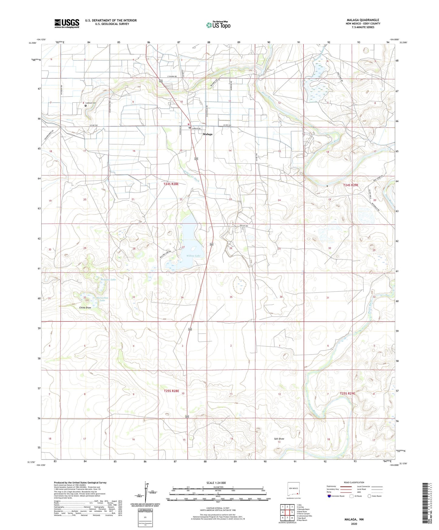
2020 topographic map quadrangle Malaga in the state of New Mexico. Scale: 1:24000. Based on the newly updated USGS 7.5' US Topo map series, this map is in the following counties: Eddy. The map contains contour data, water features, and other items you are used to seeing on USGS maps, but also has updated roads and other features. This is the next generation of topographic maps. Printed on high-quality waterproof paper with UV fade-resistant inks.
Quads adjacent to this one:
West: Bond Draw
Northwest: Otis
North: Loving
Northeast: Remuda Basin
East: Pierce Canyon
Southeast: Ross Ranch
South: Red Bluff
Southwest: Cottonwood Hills
Contains the following named places: Black River, China Draw, Chinaberry Well, Cleveland Ranch, Donaldson Well, Espejos Trail Historical Marker, Harroun Crossing, Harroun Lake Dam, Horseshoe Lake, Kelly Well, Lookout, Lookout Cemetery, Lookout Crossing, Malaga, Malaga Census Designated Place, Malaga Post Office, Malaga Volunteer Fire and Rescue, Mexican Lake, Plowman Ranch, Queen Lake, Reed Ranch, Salt Draw, Salt Draw Well, South Donaldson Well, South Reed Well, Willow Creek Ditch, Willow Lake, Willow Lake Dam