MyTopo
Mariano Lake New Mexico US Topo Map
Couldn't load pickup availability
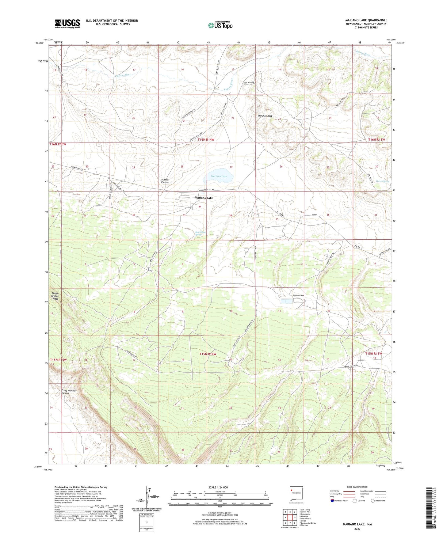
2020 topographic map quadrangle Mariano Lake in the state of New Mexico. Scale: 1:24000. Based on the newly updated USGS 7.5' US Topo map series, this map is in the following counties: McKinley. The map contains contour data, water features, and other items you are used to seeing on USGS maps, but also has updated roads and other features. This is the next generation of topographic maps. Printed on high-quality waterproof paper with UV fade-resistant inks.
Quads adjacent to this one:
West: Pinedale
Northwest: Oak Spring
North: Dalton Pass
Northeast: Crownpoint
East: Hosta Butte
Southeast: Thoreau
South: Continental Divide
Southwest: Ciniza
Contains the following named places: 10015 Water Well, Anderson Well, Berean Mission, Black Jack Mine Number Two, Carvco Spring, Crazy Woman Canyon, Dakai Well, Dutton Plateau, Holiness Indian Mission, Mac Number One, Mac Number Two, Mariano Lake, Mariano Lake - Pinedale Volunteer Fire Department, Mariano Lake Chapter, Mariano Lake Dam, McKinley County, Navajo Church, Red Willow Spring, Saint George Well, Standing Rock, Toh-Noz-Bosa Well