MyTopo
Ciniza New Mexico US Topo Map
Couldn't load pickup availability
Also explore the Ciniza Forest Service Topo of this same quad for updated USFS data
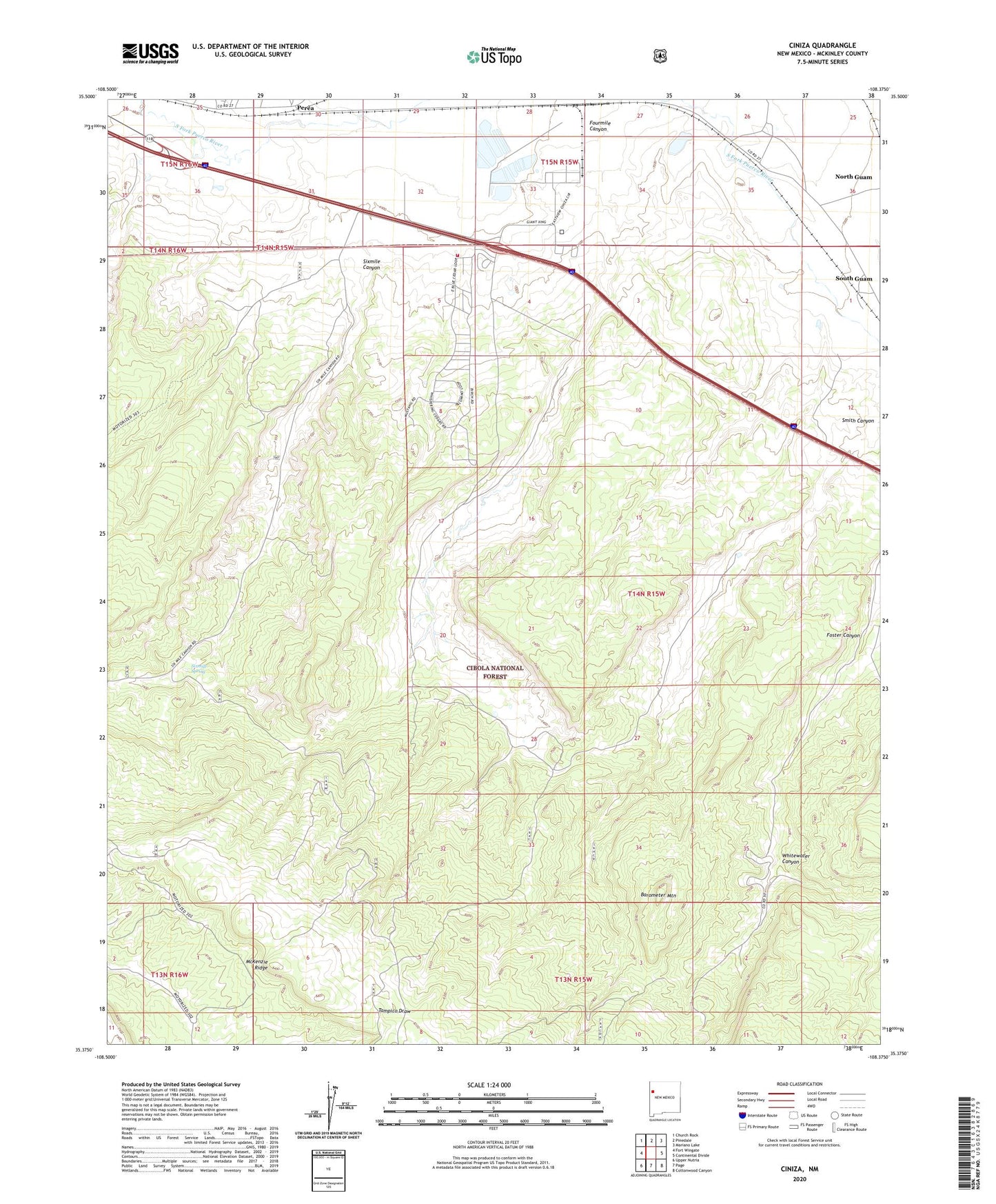
2023 topographic map quadrangle Ciniza in the state of New Mexico. Scale: 1:24000. Based on the newly updated USGS 7.5' US Topo map series, this map is in the following counties: McKinley. The map contains contour data, water features, and other items you are used to seeing on USGS maps, but also has updated roads and other features. This is the next generation of topographic maps. Printed on high-quality waterproof paper with UV fade-resistant inks.
Quads adjacent to this one:
West: Fort Wingate
Northwest: Church Rock
North: Pinedale
Northeast: Mariano Lake
East: Continental Divide
Southeast: Cottonwood Canyon
South: Page
Southwest: Upper Nutria
This map covers the same area as the classic USGS quad with code o35108d4.
Contains the following named places: 10001 Water Well, 10005 Water Well, 87347, Barometer Mountain, Brushy-One Tank, Brushy-Two Tank, Ciniza, Ciniza Refinery, Deer Stock Tank, Foster Canyon Group, Fourmile Canyon, Grenko Mine, Jamestown, Jamestown Census Designated Place, North Tank, Perea Post Office, Section Six Tank, Six A Ranch, Sixmile Canyon, Sixmile Spring, South Guam, Whispering Cedars Volunteer Fire Department, Whitewater Canyon, Willow Creek, Windmill Tank, Yellow Stock Tank