MyTopo
Continental Divide New Mexico US Topo Map
Couldn't load pickup availability
Also explore the Continental Divide Forest Service Topo of this same quad for updated USFS data
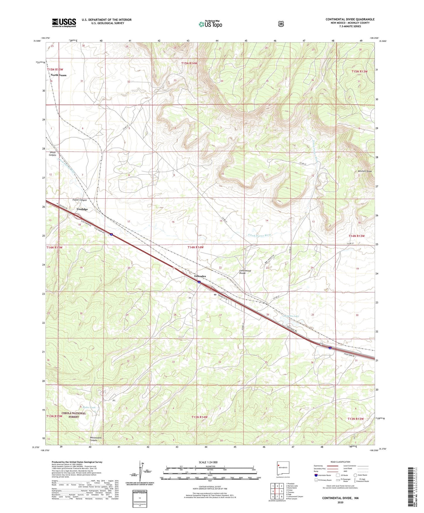
2023 topographic map quadrangle Continental Divide in the state of New Mexico. Scale: 1:24000. Based on the newly updated USGS 7.5' US Topo map series, this map is in the following counties: McKinley. The map contains contour data, water features, and other items you are used to seeing on USGS maps, but also has updated roads and other features. This is the next generation of topographic maps. Printed on high-quality waterproof paper with UV fade-resistant inks.
Quads adjacent to this one:
West: Ciniza
Northwest: Pinedale
North: Mariano Lake
Northeast: Hosta Butte
East: Thoreau
Southeast: Pine Canyon
South: Cottonwood Canyon
Southwest: Page
This map covers the same area as the classic USGS quad with code o35108d3.
Contains the following named places: 16-T-350 Water Well, 87312, Continental Divide, Continental Divide Air Force Station, Continental Divide Census Designated Place, Continental Divide Historical Marker, Continental Divide Post Office, Coolidge, Coolidge Navajo Church, Coolidge Post Office, Dewey, Dewey Post Office, Foster Canyon, Gonzales, Gonzales Lake, Gonzales Siding, Last Chance Z Uranium Deposit, North Guam, Radar Tank, Smith Canyon, Thoreau Chapter, Top of World, Transwestern Pipeline Number 5 Airport, United States Forest Service Continental Divide Training Center