MyTopo
Marquez New Mexico US Topo Map
Couldn't load pickup availability
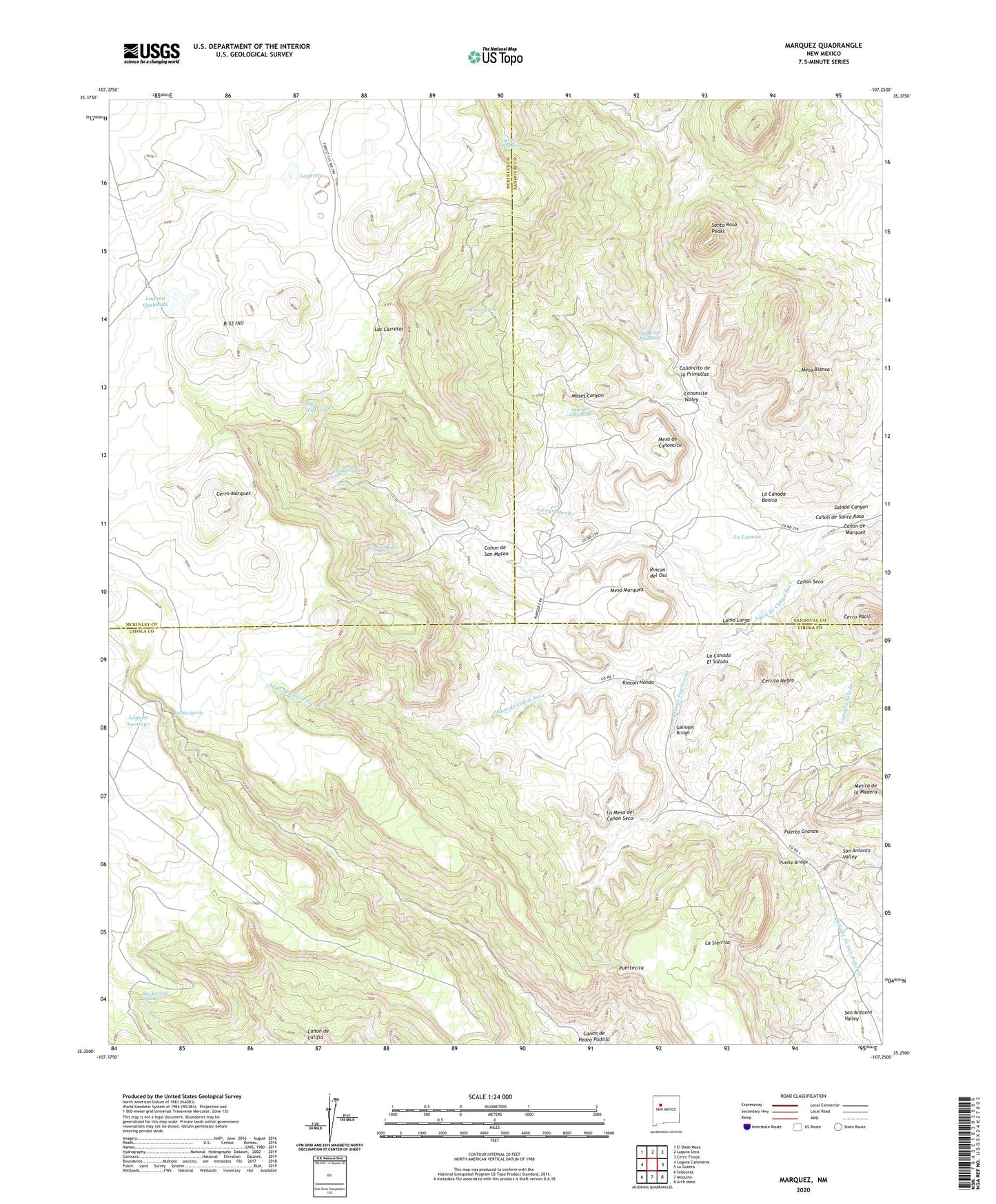
2020 topographic map quadrangle Marquez in the state of New Mexico. Scale: 1:24000. Based on the newly updated USGS 7.5' US Topo map series, this map is in the following counties: Cibola, McKinley, Sandoval. The map contains contour data, water features, and other items you are used to seeing on USGS maps, but also has updated roads and other features. This is the next generation of topographic maps. Printed on high-quality waterproof paper with UV fade-resistant inks.
Quads adjacent to this one:
West: Laguna Canoneros
Northwest: El Dado Mesa
North: Laguna Seca
Northeast: Cerro Tinaja
East: La Gotera
Southeast: Arch Mesa
South: Moquino
Southwest: Seboyeta
Contains the following named places: Agua de Canon Seco, Agua del Canoncito, Arroyo Hondo, Arroyo Puertecita, B-52 Hill, Canon de Califia, Canon de Juan Tafoya, Canon de Marquez, Canon de San Mateo, Canon de Santa Rosa, Canon Seco, Canoncito de la Primallas, Canoncito Valley, Cebolleta Grant, Cerrito Negro, Cerro Marquez, Cerro Vacio, Cueva de los Novios, Diablo Spring, El Bosque, Gallegos Bridge, La Canada Bonita, La Canada El Salado, La Laguna, La Mesa del Canon Seco, La Sierrita, Laguna Quebrada, Laguna Santiago, Lagunita, Las Carretas, Las Cuevas de Marquez, Loma Larga, Marquez, Marquez Canyon Mine, Marquez W Water Well, Mesa Blanca, Mesa de Canoncito, Mesa Marquez, Mesita Redondita, MMW-1 Water Well, Moses Canyon, Moses Spring, Ojo de las Primallas, Ojo Estaliando, Ojo los Rechuelos, Ojo Marquez, Ojo San Mateo, Ojo Tecolote Springs, Puertecita, Puerto Bridge, Puerto Grande, Rincon Blanco, Rincon del Oso, Rincon Hondo, San Antonio Valley, Santa Rosa Peaks