MyTopo
McCartys New Mexico US Topo Map
Couldn't load pickup availability
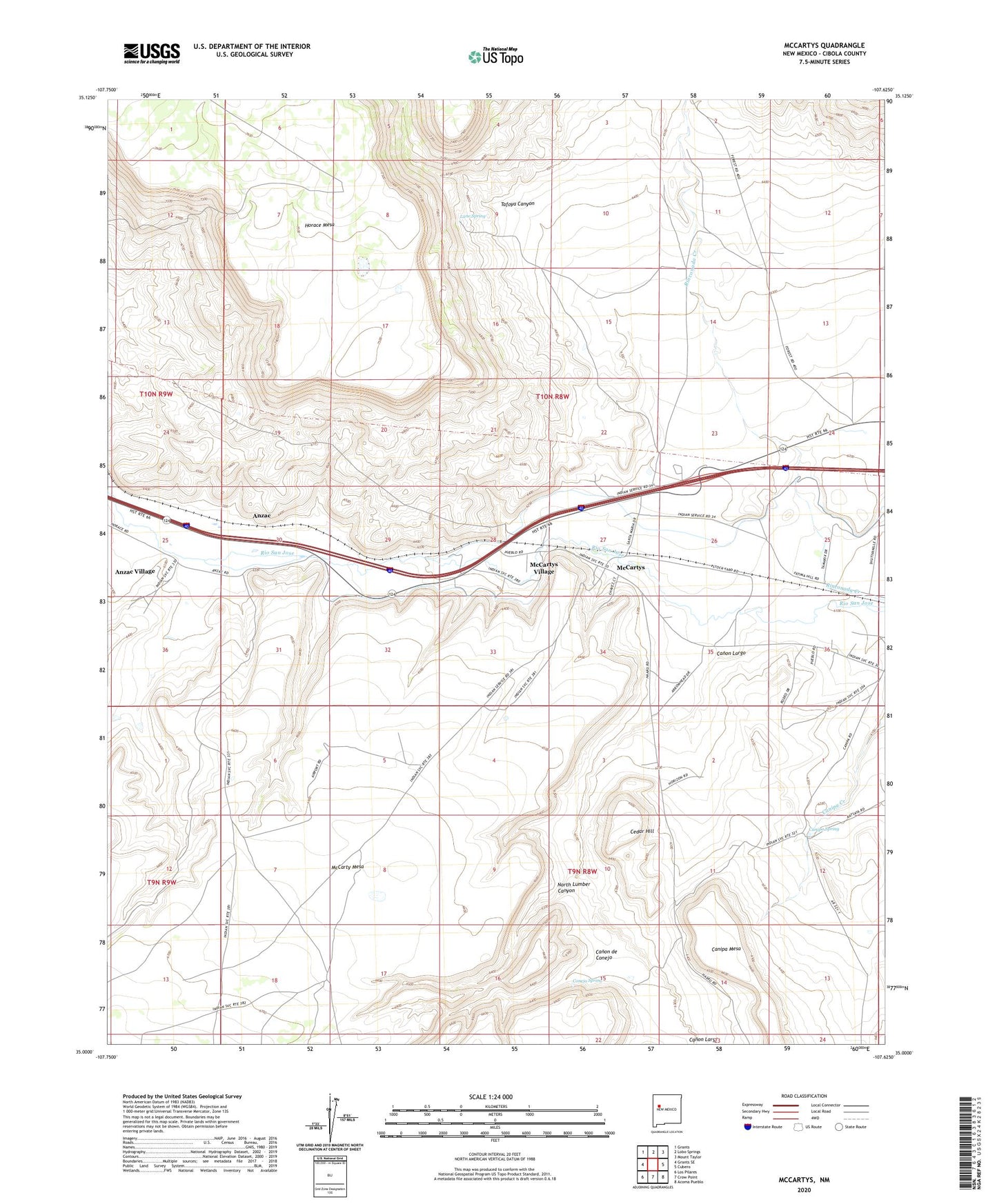
2023 topographic map quadrangle McCartys in the state of New Mexico. Scale: 1:24000. Based on the newly updated USGS 7.5' US Topo map series, this map is in the following counties: Cibola. The map contains contour data, water features, and other items you are used to seeing on USGS maps, but also has updated roads and other features. This is the next generation of topographic maps. Printed on high-quality waterproof paper with UV fade-resistant inks.
Quads adjacent to this one:
West: Grants SE
Northwest: Grants
North: Lobo Springs
Northeast: Mount Taylor
East: Cubero
Southeast: Acoma Pueblo
South: Crow Point
Southwest: Los Pilares
This map covers the same area as the classic USGS quad with code o35107a6.
Contains the following named places: 10027 Water Well, 10032 Water Well, Acoma 2 Water Well, Airport WL Water Well, Anzac, Anzac 86-1 Water Well, Anzac Village Census Designated Place, Basalt Quarry, Canipa Mesa, Canipa Spring, Canon de Conejo, Canon Largo, Cedar Hill, Chief Rancho, Conejo Spring, Lane Ranch, Lane Spring, McCarty Mesa, McCartys, McCartys Siding, McCartys Village Census Designated Place, Mount of Peace Cemetery, North Lumber Canyon, Santa Maria Mission, Tafoya Canyon, Test Well 3 Water Well