MyTopo
Milligan Mountain New Mexico US Topo Map
Couldn't load pickup availability
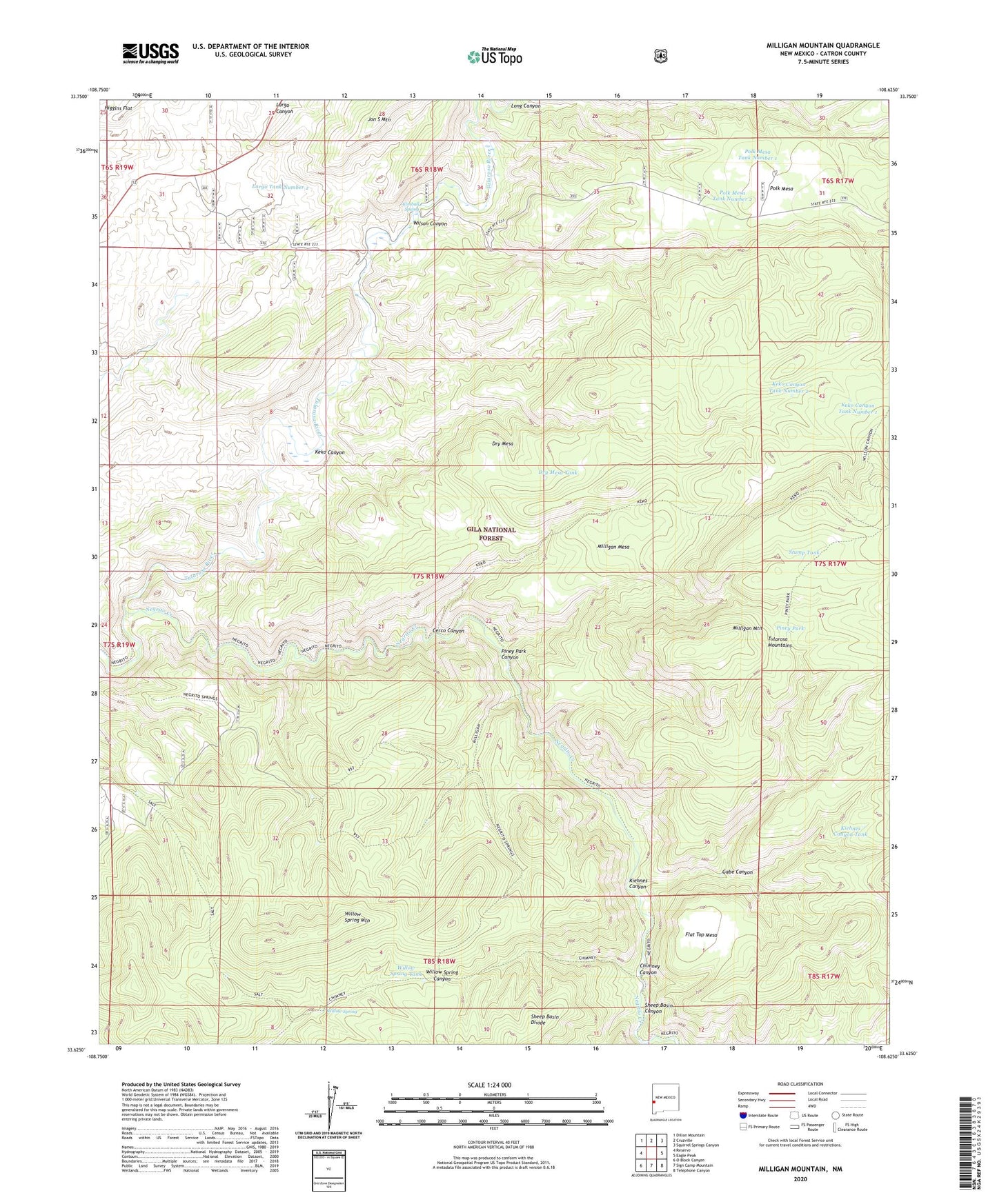
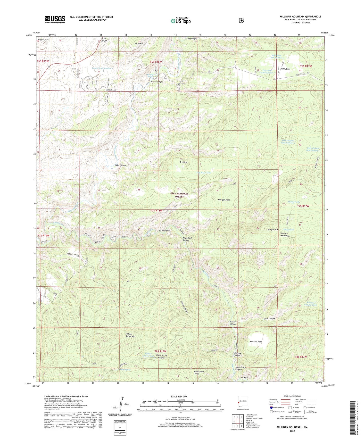
2020 topographic map quadrangle Milligan Mountain in the state of New Mexico. Scale: 1:24000. Based on the newly updated USGS 7.5' US Topo map series, this map is in the following counties: Catron. The map contains contour data, water features, and other items you are used to seeing on USGS maps, but also has updated roads and other features. This is the next generation of topographic maps. Printed on high-quality waterproof paper with UV fade-resistant inks.
Quads adjacent to this one:
West: Reserve
Northwest: Dillon Mountain
North: Cruzville
Northeast: Squirrel Springs Canyon
East: Eagle Peak
Southeast: Telephone Canyon
South: Sign Camp Mountain
Southwest: O Block Canyon
Contains the following named places: Cerco Canyon, Chimney Canyon, Dry Mesa, Dry Mesa Tank, Flat Top Mesa, Frisco Plaza Number 5 Tank, Gabe Canyon, Keko Canyon, Keko Canyon Tank Number 1, Keko Canyon Tank Number 2, Kiehnes Canyon, Kiehnes Canyon Tank, Kimball Spring, Largo Tank Number 2, Long Canyon, Milligan Mesa, Milligan Mountain, Negrito Creek, Piney Park, Piney Park Canyon, Polk Mesa, Polk Mesa Tank Number 1, Polk Mesa Tank Number 2, Sheep Basin Canyon, Stump Tank, Willow Spring, Willow Spring Mountain, Willow Spring Tank, Wilson Canyon, ZIP Code: 87830