MyTopo
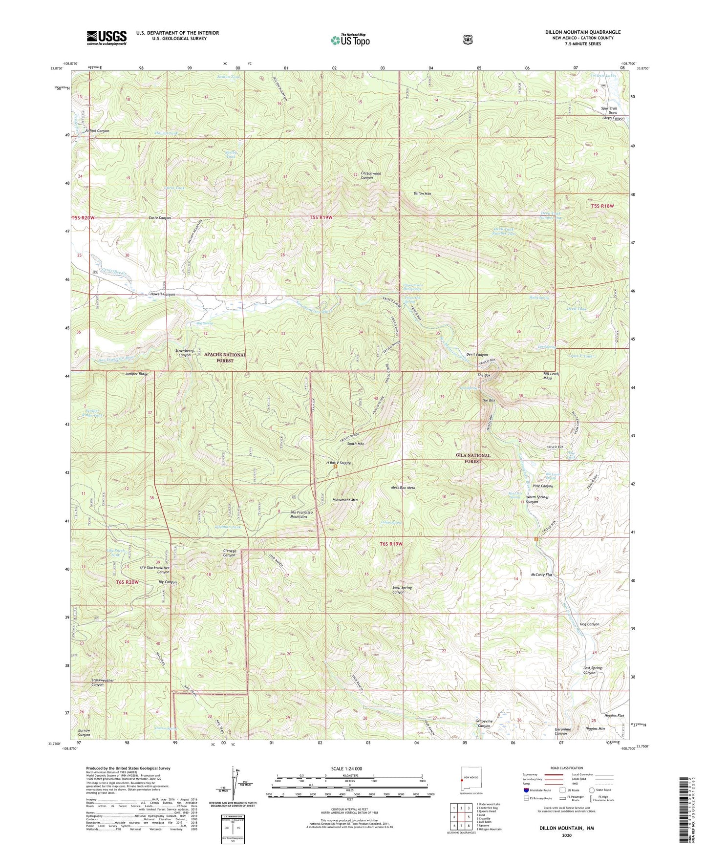
Dillon Mountain New Mexico US Topo Map
Couldn't load pickup availability
Also explore the Dillon Mountain Forest Service Topo of this same quad for updated USFS data
2023 topographic map quadrangle Dillon Mountain in the state of New Mexico. Scale: 1:24000. Based on the newly updated USGS 7.5' US Topo map series, this map is in the following counties: Catron. The map contains contour data, water features, and other items you are used to seeing on USGS maps, but also has updated roads and other features. This is the next generation of topographic maps. Printed on high-quality waterproof paper with UV fade-resistant inks.
Quads adjacent to this one:
West: Luna
Northwest: Underwood Lake
North: Centerfire Bog
Northeast: Queens Head
East: Cruzville
Southeast: Milligan Mountain
South: Reserve
Southwest: Bull Basin
This map covers the same area as the classic USGS quad with code o33108g7.
Contains the following named places: Big Spring, Bill Lewis Mesa, Bill Lewis Spring, Centerfire Creek, Crass V Tank, Curio Canyon, Curio Tank, Devil Canyon, Devil Spring, Devil Tank, Devil Tank Number One, Devil Tank Number Two, Dillon Mountain, Frisco Hot Spring, Geronimo Canyon, Grapevine Canyon, H Bar V Saddle, Heifer Basin Tank, Hog Canyon, Howell Canyon, Howell Tank, Hudson Spring, Indian Spring, Joshua Canyon, Joshua Tank, Juniper Ridge, Juniper Ridge Tank, Liedman Tank, Lily Patch Tank, Lion Spring, Lonnie Tank, Lost Spring Canyon, McCarty Flat, Mess Box Mesa, Mess Box Spring, Miller Ranch, Monument Mountain, Pine Canyon, Pine Tank, Seep Spring Canyon, Shelby Tank, Skunk Spring, South Mountain, Spur Trail Draw, Strawberry Canyon, Strawberry Tank, The Box, Toriette Lakes, Upper Frisco Hot Springs, Warm Springs Canyon