MyTopo
Sign Camp Mountain New Mexico US Topo Map
Couldn't load pickup availability
Also explore the Sign Camp Mountain Forest Service Topo of this same quad for updated USFS data
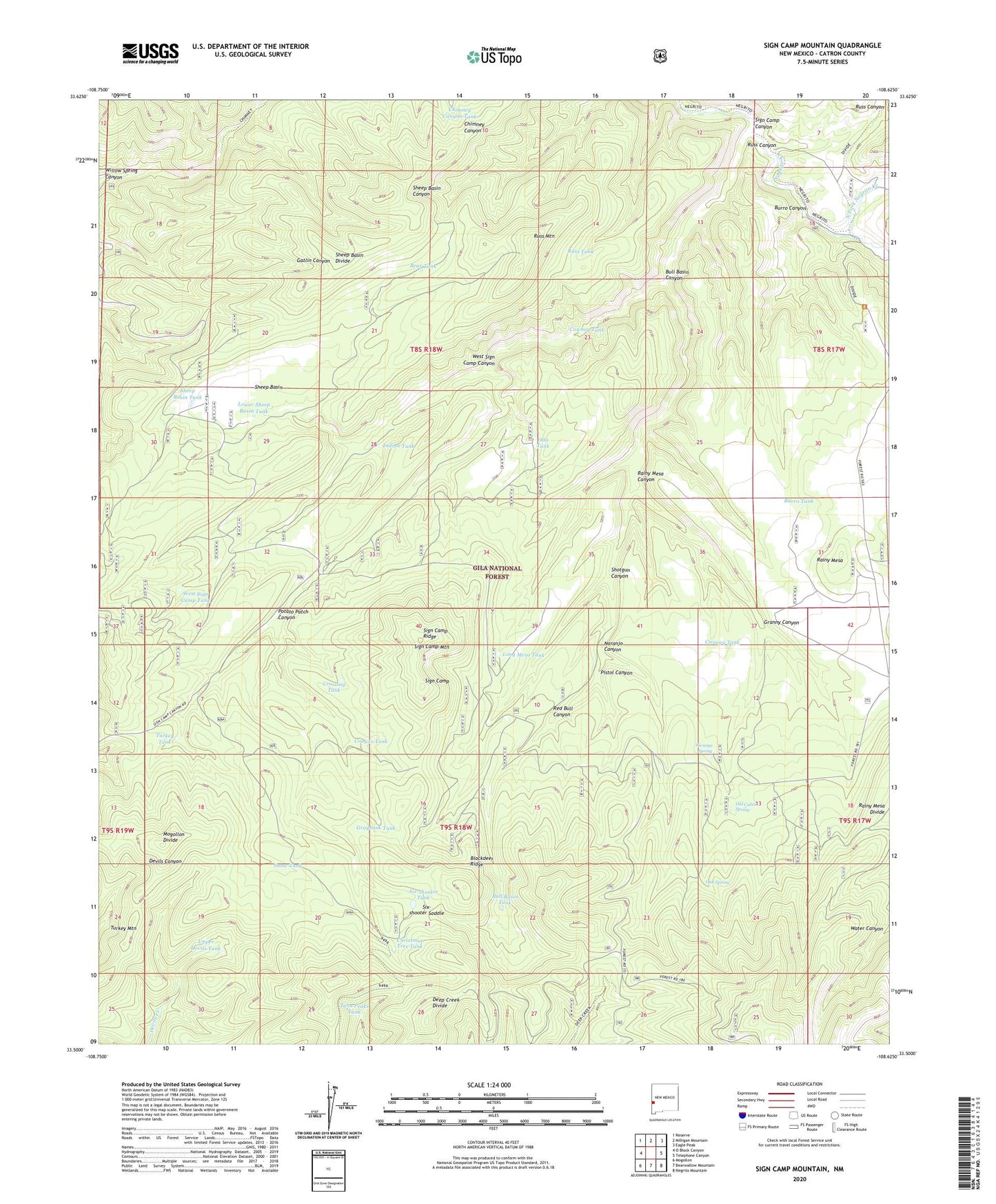
2023 topographic map quadrangle Sign Camp Mountain in the state of New Mexico. Scale: 1:24000. Based on the newly updated USGS 7.5' US Topo map series, this map is in the following counties: Catron. The map contains contour data, water features, and other items you are used to seeing on USGS maps, but also has updated roads and other features. This is the next generation of topographic maps. Printed on high-quality waterproof paper with UV fade-resistant inks.
Quads adjacent to this one:
West: O Block Canyon
Northwest: Reserve
North: Milligan Mountain
Northeast: Eagle Peak
East: Telephone Canyon
Southeast: Negrito Mountain
South: Bearwallow Mountain
Southwest: Mogollon
This map covers the same area as the classic USGS quad with code o33108e6.
Contains the following named places: Apache Peak Trail, Bear Tank, Blackdeer Ridge, Bull Basin Canyon, Bull Basin Tank, Burro Canyon, Burro Tank, Chimney Canyon Tank, Christmas Tree Tank, Cicnega Spring, Cienega Tank, Cougar Tank, Cowboy Tank, Crossing Tank, Deep Creek Divide, Granny Canyon, Grayback Tank, Indian Tank, Kiehne Ranch, Long Mesa Tank, Lower Sheep Basin Tank, Mogollon Divide, Naranjo Canyon, North Fork Negrito Creek, Oak Spring, Old Cabin Spring, Olla Tank, Pistol Canyon, Potato Patch Canyon, Rainy Mesa, Rainy Mesa Airstrip, Rainy Mesa Canyon, Rainy Mesa Divide, Red Bull Canyon, Reserve Division, Russ Canyon, Russ Mountain, Russ Tank, Sheep Basin, Sheep Basin Divide, Sheep Basin Tank, Shotgun Canyon, Sign Camp, Sign Camp Canyon, Sign Camp Mountain, Sign Camp Ridge, Six-shooter Saddle, Six-shooter Tank, Snow Tank, South Fork Negrito Creek, Turkey Tank, Twin Peaks Tank, Upper Devils Tank, West Sign Camp Canyon, West Sign Camp Tank