MyTopo
Telephone Canyon New Mexico US Topo Map
Couldn't load pickup availability
Also explore the Telephone Canyon Forest Service Topo of this same quad for updated USFS data
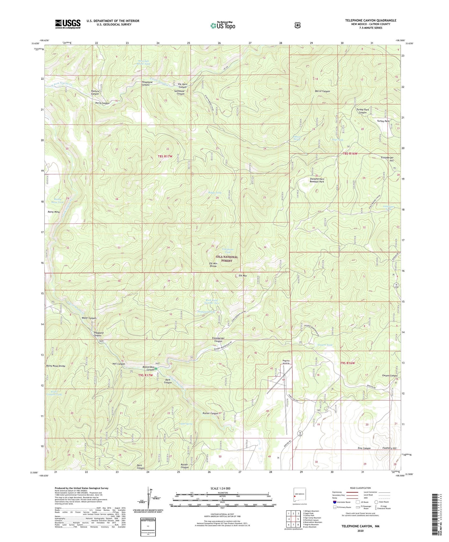
2023 topographic map quadrangle Telephone Canyon in the state of New Mexico. Scale: 1:24000. Based on the newly updated USGS 7.5' US Topo map series, this map is in the following counties: Catron. The map contains contour data, water features, and other items you are used to seeing on USGS maps, but also has updated roads and other features. This is the next generation of topographic maps. Printed on high-quality waterproof paper with UV fade-resistant inks.
Quads adjacent to this one:
West: Sign Camp Mountain
Northwest: Milligan Mountain
North: Eagle Peak
Northeast: Collins Park
East: Pitchfork Canyon
Southeast: Loco Mountain
South: Negrito Mountain
Southwest: Bearwallow Mountain
This map covers the same area as the classic USGS quad with code o33108e5.
Contains the following named places: Beaverdam Canyon, Brennand Ranch, Dark Canyon, Eckleberger Canyon, Eckleberger Hill, Eckleberger Spring, Elk Horn Canyon, Elk Mountain, Elk Mountain Divide, Elkhorn Spring, Feathery Hill, Gilson Ranch, Gwynn Camp, Gwynn Canyon, Gwynn Cienega, Gwynn Tank, Hail Canyon, Logger Spring, Negrito Airstrip, Negrito Work Center, Pasture Canyon, Perry Canyon, Rainy Mesa Camp, Rainy Mesa Tank, Ridge Tank, Rock Tank Number Two, Rock Tanks, Rocker Canyon, Salthouse Canyon, Sheepherders Baseball Park, Sheppard Canyon, Sheppard Tank, Telephone Canyon, Telephone Tank, Top Tank, Turkey Park, Water Canyon, Water Canyon Tank, West Salt House Tank, Yequas Park