MyTopo
Monero New Mexico US Topo Map
Couldn't load pickup availability
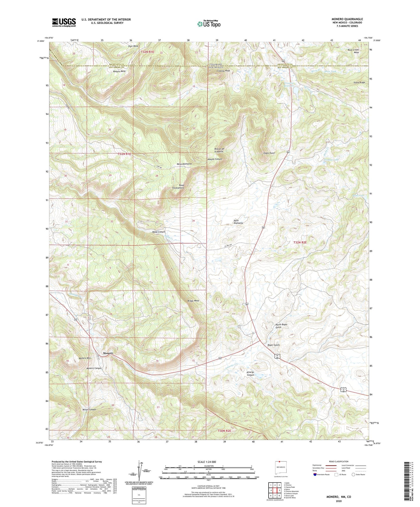
2020 topographic map quadrangle Monero in the state of New Mexico. Scale: 1:24000. Based on the newly updated USGS 7.5' US Topo map series, this map is in the following counties: Rio Arriba, Archuleta. The map contains contour data, water features, and other items you are used to seeing on USGS maps, but also has updated roads and other features. This is the next generation of topographic maps. Printed on high-quality waterproof paper with UV fade-resistant inks.
Quads adjacent to this one:
West: Dulce
Northwest: Edith
North: Chromo
Northeast: Chama Peak
East: Chromo Mountain
Southeast: Sawmill Mesa
South: Horse Lake
Southwest: Cordova Canyon
Contains the following named places: Abeyta Mesa, Abeyta Ranch, Barney Quaranto Mine, Biggs, Boyer Gulch, Boyer Lake, Briggs Mesa, Caranta Lease, Caranta Mine, Caranta Mines, Caranti Brothers Mine, Crowley Irrigation System Dam, Crowley Peak, Crowley Reservoir, Diamante, Eagle Point, Early Mine, Gonzales Ranch, Martinez Prospect, Mc Elroy Brothers Mine, McBroom Mine, Mesa Diamante, Miller Canyon, Monero, Monero Canyon, Monero Mountain, Monero Post Office, North Boyer Gulch, Prince Ranch, Rancho Diamante, Reed Escarpment, Rincon de la Aguila, Rock Creek Mesa, San Luis Mine, Sczerbiak Prospect, Stove Tank, Tecolote Lake, Tomacino Mine, Torres, Torrez Ranch, Valle Diamante, Western Fuel Company Mine