MyTopo
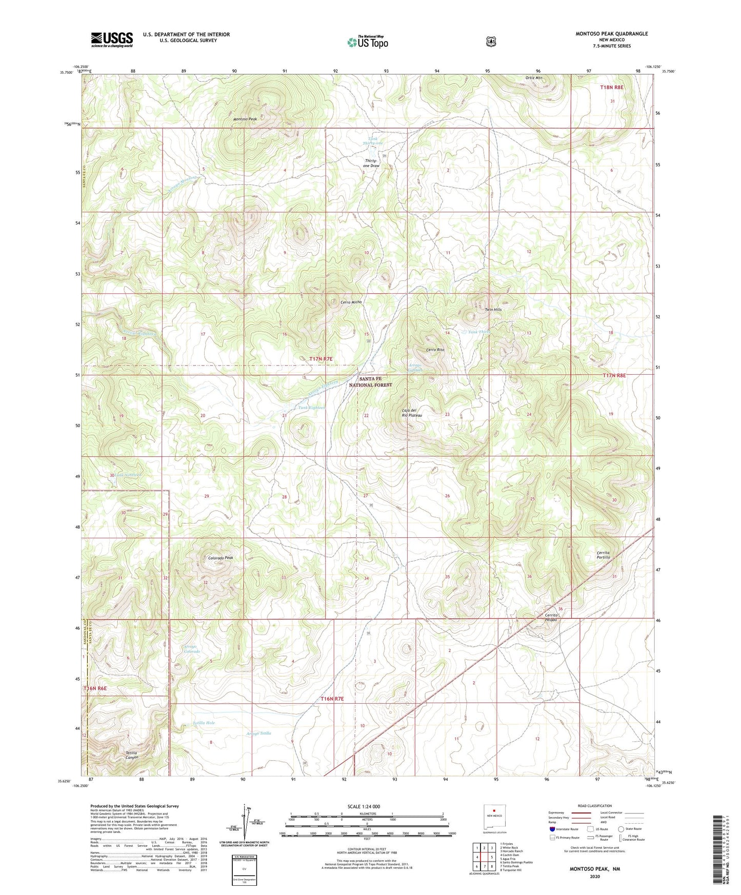
Montoso Peak New Mexico US Topo Map
Couldn't load pickup availability
Also explore the Montoso Peak Forest Service Topo of this same quad for updated USFS data
2023 topographic map quadrangle Montoso Peak in the state of New Mexico. Scale: 1:24000. Based on the newly updated USGS 7.5' US Topo map series, this map is in the following counties: Santa Fe, Sandoval. The map contains contour data, water features, and other items you are used to seeing on USGS maps, but also has updated roads and other features. This is the next generation of topographic maps. Printed on high-quality waterproof paper with UV fade-resistant inks.
Quads adjacent to this one:
West: Cochiti Dam
Northwest: Frijoles
North: White Rock
Northeast: Horcado Ranch
East: Agua Fria
Southeast: Turquoise Hill
South: Tetilla Peak
Southwest: Santo Domingo Pueblo
This map covers the same area as the classic USGS quad with code o35106f2.
Contains the following named places: 1100 Water Well, Arroyo Colorado, Arroyo Tetilla, Caja del Rio Grant, Caja del Rio Plateau, Cerrita Portillo, Cerrito Pelado, Cerro Micho, Cerro Rito, Colorado Peak, Department of Agriculture Experimental Area, Eleven Hundred Well, Espanola Ranger District, Montoso Peak, North Red Bird, Ortiz Mountain, Red Bird, RG-25499 Water Well, Rito Horse Trap, Tank Eighteen, Tank Nineteen, Tank Thirty, Tank Thirty-one, Tetilla Hole, Thirty-one Draw, Twelve Hundred Well, Twin Hills