MyTopo
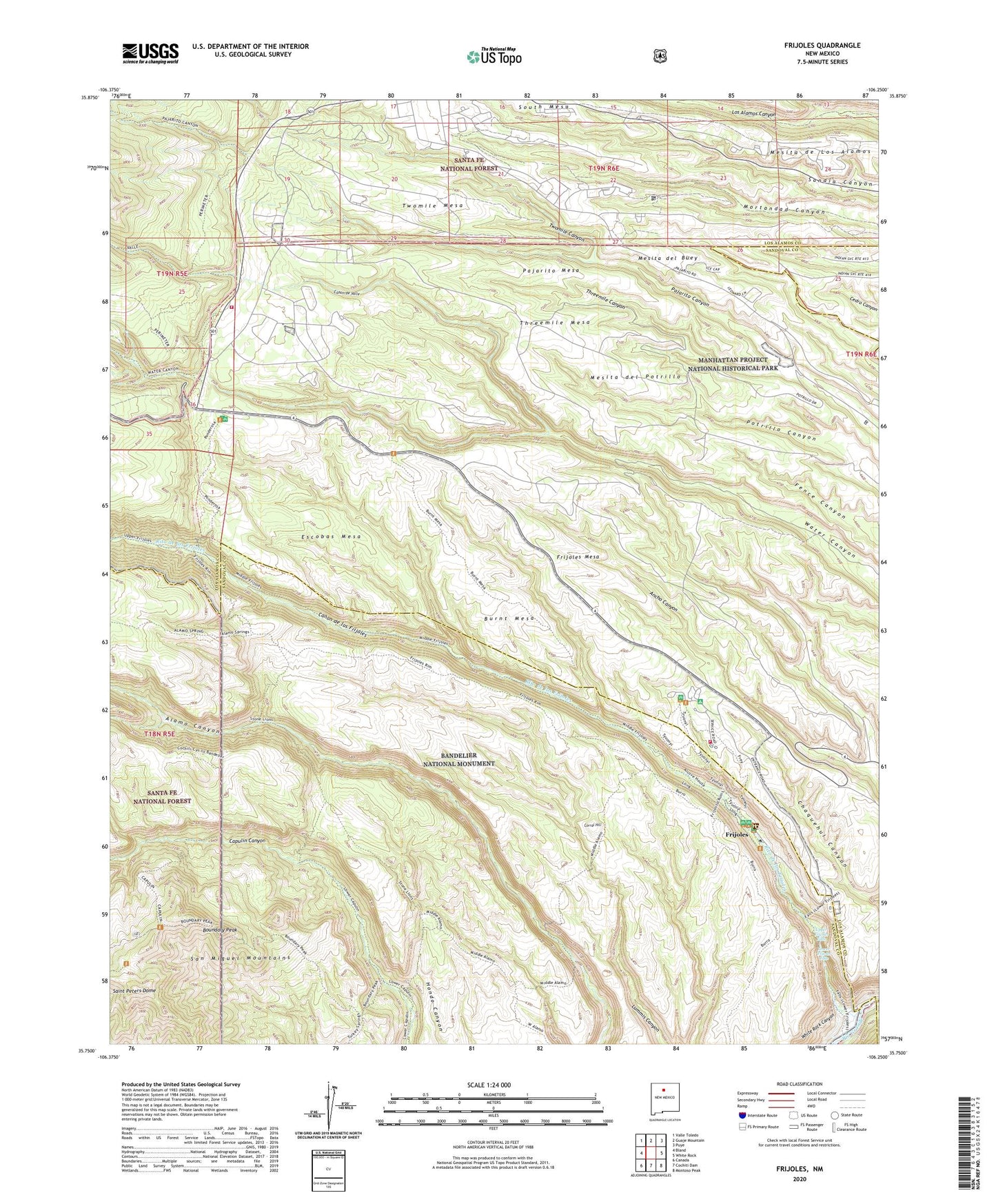
Frijoles New Mexico US Topo Map
Couldn't load pickup availability
Also explore the Frijoles Forest Service Topo of this same quad for updated USFS data
2023 topographic map quadrangle Frijoles in the state of New Mexico. Scale: 1:24000. Based on the newly updated USGS 7.5' US Topo map series, this map is in the following counties: Sandoval, Los Alamos. The map contains contour data, water features, and other items you are used to seeing on USGS maps, but also has updated roads and other features. This is the next generation of topographic maps. Printed on high-quality waterproof paper with UV fade-resistant inks.
Quads adjacent to this one:
West: Bland
Northwest: Valle Toledo
North: Guaje Mountain
Northeast: Puye
East: White Rock
Southeast: Montoso Peak
South: Cochiti Dam
Southwest: Canada
This map covers the same area as the classic USGS quad with code o35106g3.
Contains the following named places: Alamo Springs Trail, Bandelier National Monument, Bandelier National Monument Historical Marker, Bandelier National Monument Interagency Fire Station, Bandelier Wilderness, Bland Frijoles Trail, Boundary Peak, Burnt Mesa, Canon de los Frijoles, Canon de Valle, Corral Hill, Dome Lookout Tower, Escobas Mesa, Frijoles, Frijoles Mesa, Frijoles Pueblo Ruins, Frijoles Stone Lions Trail, Juniper Campground, Los Alamos County, Los Alamos Fire Department Station 5, Los Alamos National Laboratory, Lower Frijoles Falls, Mesita de Los Alamos, Mesita del Buey, Mesita del Potrillo, Pajarito Mesa, Ponderosa Group Campground, Pueblo of the Stone Lions, Rainbow House, Ramon Vigil Grant, Rito de los Frijoles, Sacred Area San Ildefonso Indian Reservation, Saint Peters Dome, Stone Lions Shrine, Threemile Canyon, Threemile Mesa, Twomile Canyon, Twomile Mesa, Tyuonyi Ruin, Upper Frijoles Crossing, Upper Frijoles Falls, Water Canyon Trail, ZIP Code: 87544