MyTopo
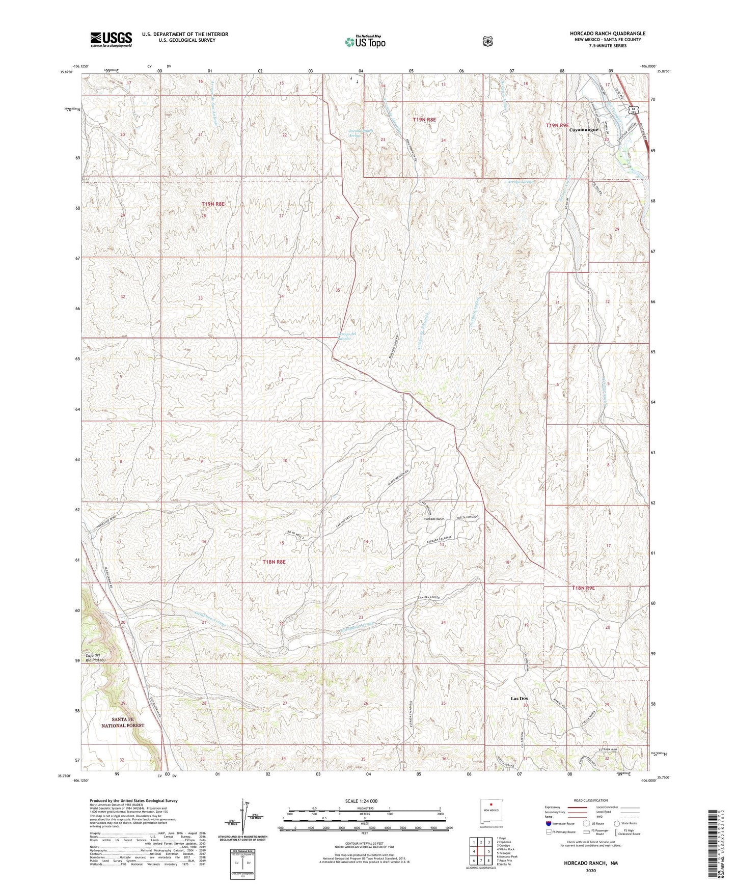
Horcado Ranch New Mexico US Topo Map
Couldn't load pickup availability
Also explore the Horcado Ranch Forest Service Topo of this same quad for updated USFS data
2023 topographic map quadrangle Horcado Ranch in the state of New Mexico. Scale: 1:24000. Based on the newly updated USGS 7.5' US Topo map series, this map is in the following counties: Santa Fe. The map contains contour data, water features, and other items you are used to seeing on USGS maps, but also has updated roads and other features. This is the next generation of topographic maps. Printed on high-quality waterproof paper with UV fade-resistant inks.
Quads adjacent to this one:
West: White Rock
Northwest: Puye
North: Espanola
Northeast: Cundiyo
East: Tesuque
Southeast: Santa Fe
South: Agua Fria
Southwest: Montoso Peak
This map covers the same area as the classic USGS quad with code o35106g1.
Contains the following named places: Calabasa Arroyo, Cuyamungue, Cuyamungue Census Designated Place, Fraction Mine, Horcado Ranch, Jacona Grant, Kosack Mining Company Mine, Las Dos, Norton Substation, RG-10843 Water Well, RG-11784 Water Well, RG-20606 Water Well, RG-26777 Water Well, RG-27065 Water Well, RG-2833 Water Well, RG-438 Water Well, RG-6386 Water Well