MyTopo
Mount Taylor New Mexico US Topo Map
Couldn't load pickup availability
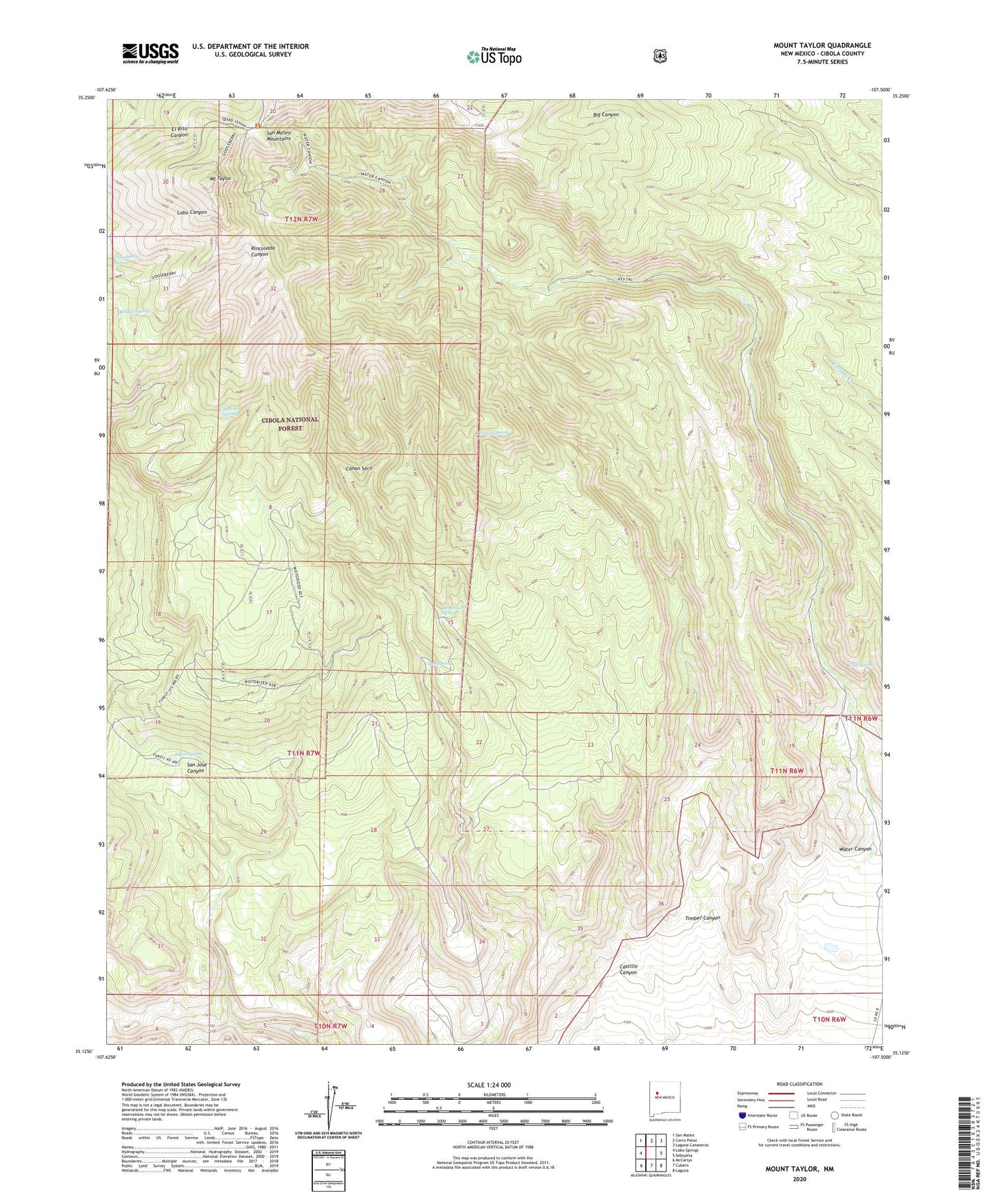
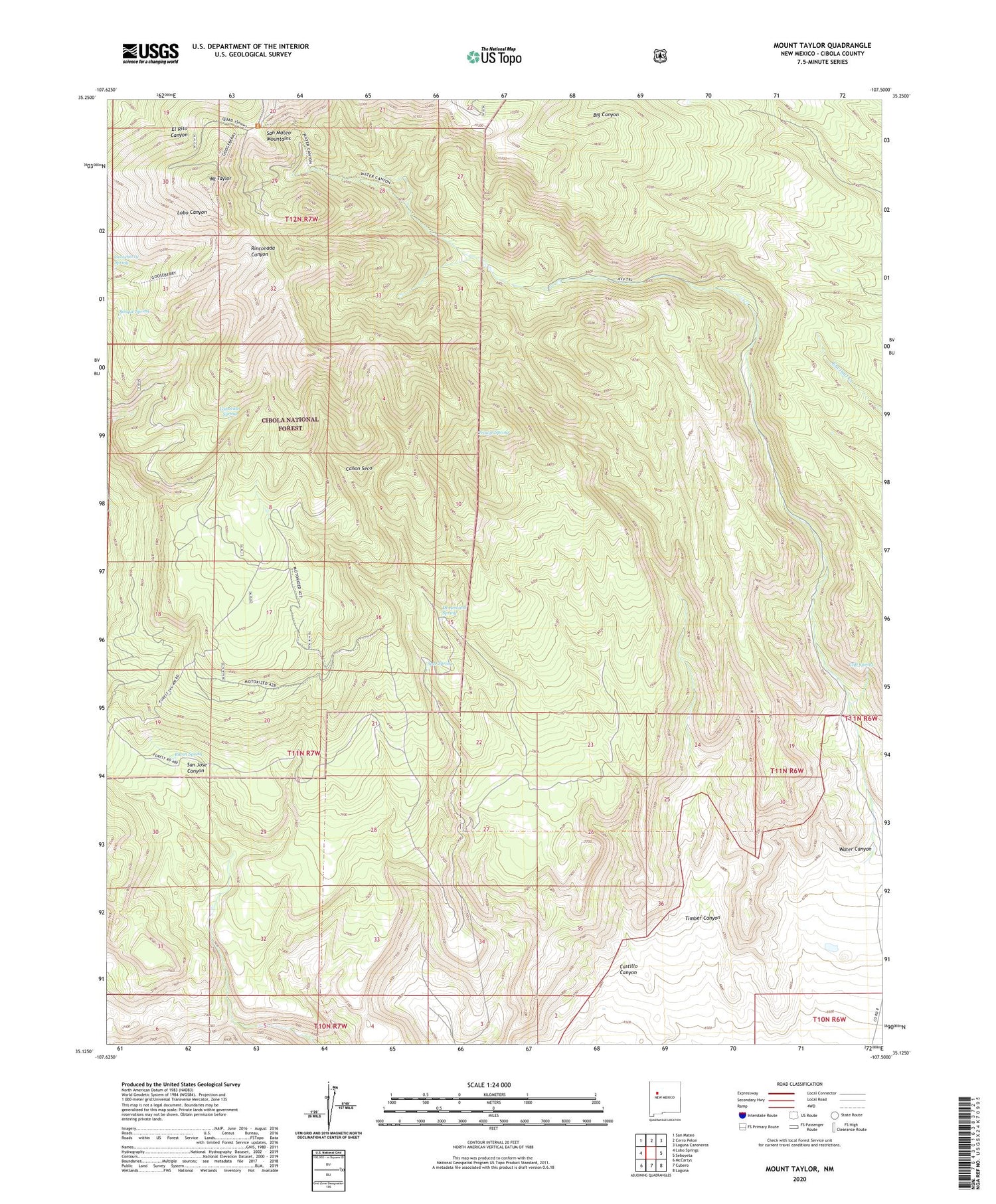
2020 topographic map quadrangle Mount Taylor in the state of New Mexico. Scale: 1:24000. Based on the newly updated USGS 7.5' US Topo map series, this map is in the following counties: Cibola. The map contains contour data, water features, and other items you are used to seeing on USGS maps, but also has updated roads and other features. This is the next generation of topographic maps. Printed on high-quality waterproof paper with UV fade-resistant inks.
Quads adjacent to this one:
West: Lobo Springs
Northwest: San Mateo
North: Cerro Pelon
Northeast: Laguna Canoneros
East: Seboyeta
Southeast: Laguna
South: Cubero
Southwest: McCartys
Contains the following named places: Big Canyon, Bosque Spring, Canovitas Spring, Castillo Canyon, Castillo One Water Well, Cliff Spring, De Armand Spring, Gooseberry Spring, Mount Taylor, Mount Taylor Historical Marker, Mount Taylor Mine, Raton Spring, Seco Spring, Timber Canyon, Trough Spring, Tso-Dzil Ranch, Water Canyon