MyTopo
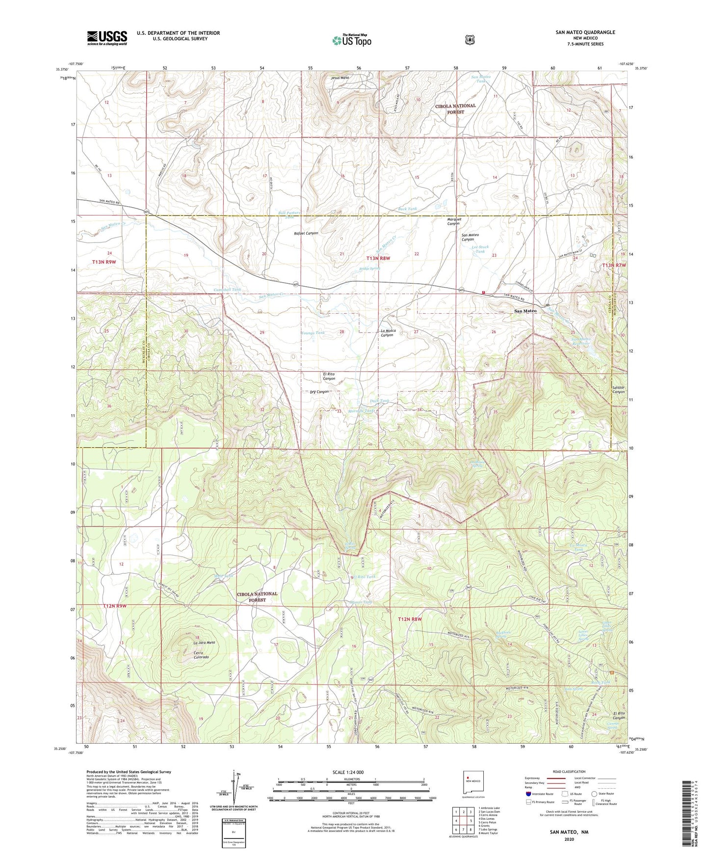
San Mateo New Mexico US Topo Map
Couldn't load pickup availability
Also explore the San Mateo Forest Service Topo of this same quad for updated USFS data
2023 topographic map quadrangle San Mateo in the state of New Mexico. Scale: 1:24000. Based on the newly updated USGS 7.5' US Topo map series, this map is in the following counties: Cibola, McKinley. The map contains contour data, water features, and other items you are used to seeing on USGS maps, but also has updated roads and other features. This is the next generation of topographic maps. Printed on high-quality waterproof paper with UV fade-resistant inks.
Quads adjacent to this one:
West: Dos Lomas
Northwest: Ambrosia Lake
North: San Lucas Dam
Northeast: Cerro Alesna
East: Cerro Pelon
Southeast: Mount Taylor
South: Lobo Springs
Southwest: Grants
This map covers the same area as the classic USGS quad with code o35107c6.
Contains the following named places: Bajios Largo, Bajios Redondos, Bridge Spring, Buck Tank, Buckhorn Spring, Bull Pasture Tank, Campbell Tank, Cerro Colorado, Cienaga Spring, Dry Canyon, Duck Tank, El Rito Canyon, El Rito Spring, El Rito Tank, Fernandez, Jesus Mesa, Johnny M Mine, June Mine, La Jara Mesa, La Mosca Canyon, La Mosca Spring, La Mosca Tank, Lee, Lee Ranch, Lee Stock Tank, Lower Lillies Spring, Marcus Ranch, Marquez Canyon, Mimes Tank, Mormon Tank, Mule Tank, Palo Verde Group, Rafael Canyon, Rock Spring, Rock Tank, Salazar Canyon, San Mateo, San Mateo Canyon, San Mateo Cemetery, San Mateo Census Designated Place, San Mateo Church, San Mateo Elementary, San Mateo Lake Dam, San Mateo Mine, San Mateo Post Office, San Mateo Reservoir, San Mateo Springs Grant, San Mateo Tank, San Mateo Volunteer Fire and Rescue, Upper Lillies Spring, Uranium Deposit, Uranium Prospects, WX Lobo Pit, Youngs Tank