MyTopo
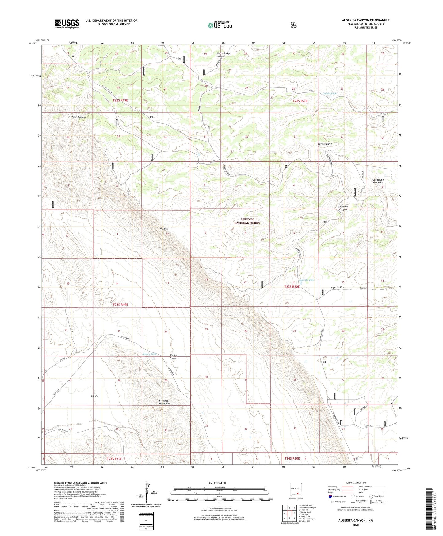
Algerita Canyon New Mexico US Topo Map
Couldn't load pickup availability
Also explore the Algerita Canyon Forest Service Topo of this same quad for updated USFS data
2023 topographic map quadrangle Algerita Canyon in the state of New Mexico. Scale: 1:24000. Based on the newly updated USGS 7.5' US Topo map series, this map is in the following counties: Otero. The map contains contour data, water features, and other items you are used to seeing on USGS maps, but also has updated roads and other features. This is the next generation of topographic maps. Printed on high-quality waterproof paper with UV fade-resistant inks.
Quads adjacent to this one:
West: Gowdy Ranch
Northwest: Panama Ranch
North: Packsaddle Canyon
Northeast: Texas Hill
East: Ares Peak
Southeast: Pickett Hill
South: La Paloma Canyon
Southwest: Sheep Draw
This map covers the same area as the classic USGS quad with code o32104c8.
Contains the following named places: Algerita Canyon, Algerita Flat, Algerita Tank, Big Dog Canyon, Calvin Tank, Coon Dog Storage Tank, Coon Dog Well, Goldylocks Water Storage Tank, Guadalupe Ranger District, Indian Tank, Jeffrey Tank, Patterson Water Storage Tank, Powers Storage Tank, Powers Well, Salt Flat, Ultimo Water Storage Tank