
MyTopo
Pelona Mountain New Mexico US Topo Map
Couldn't load pickup availability
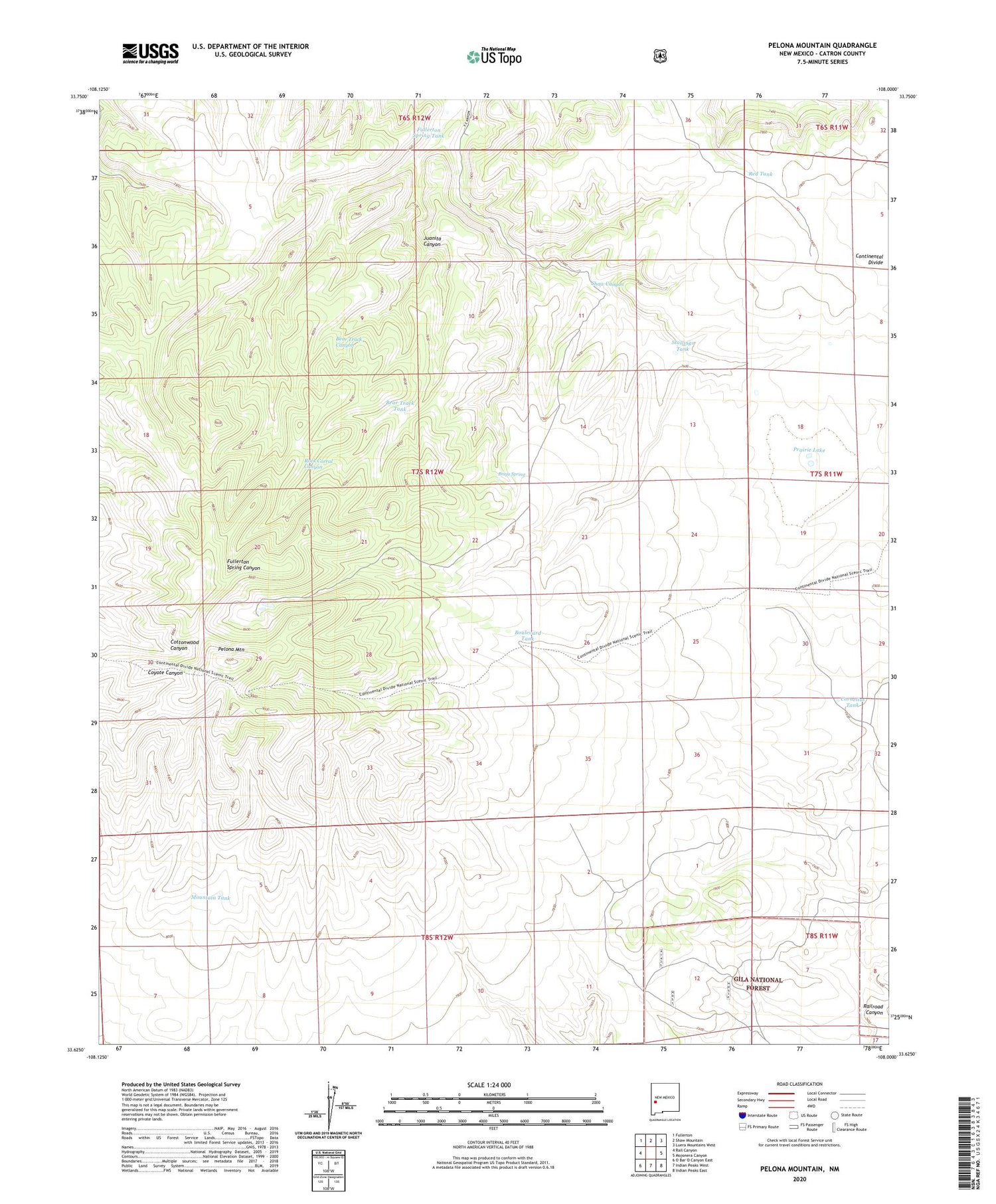
2020 topographic map quadrangle Pelona Mountain in the state of New Mexico. Scale: 1:24000. Based on the newly updated USGS 7.5' US Topo map series, this map is in the following counties: Catron. The map contains contour data, water features, and other items you are used to seeing on USGS maps, but also has updated roads and other features. This is the next generation of topographic maps. Printed on high-quality waterproof paper with UV fade-resistant inks.
Quads adjacent to this one:
West: Rail Canyon
Northwest: Fullerton
North: Shaw Mountain
Northeast: Luera Mountains West
East: Mojonera Canyon
Southeast: Indian Peaks East
South: Indian Peaks West
Southwest: O Bar O Canyon East
Contains the following named places: Bear Track Canyon, Bear Track Tank, Boulevard Tank, Bruja Spring, Chimney Water Well, Cienegita, Continental Divide Wilderness Study Area, Cornelius Tank, Fullerton Spring Tank, Juanita Canyon, Mountain Tank, Pelona Mountain, Pelona Well, Prairie Lake, Red Tank, Rock Corral Canyon, Shaw Canyon, Stallings Tank


