MyTopo
Pine Lake New Mexico US Topo Map
Couldn't load pickup availability
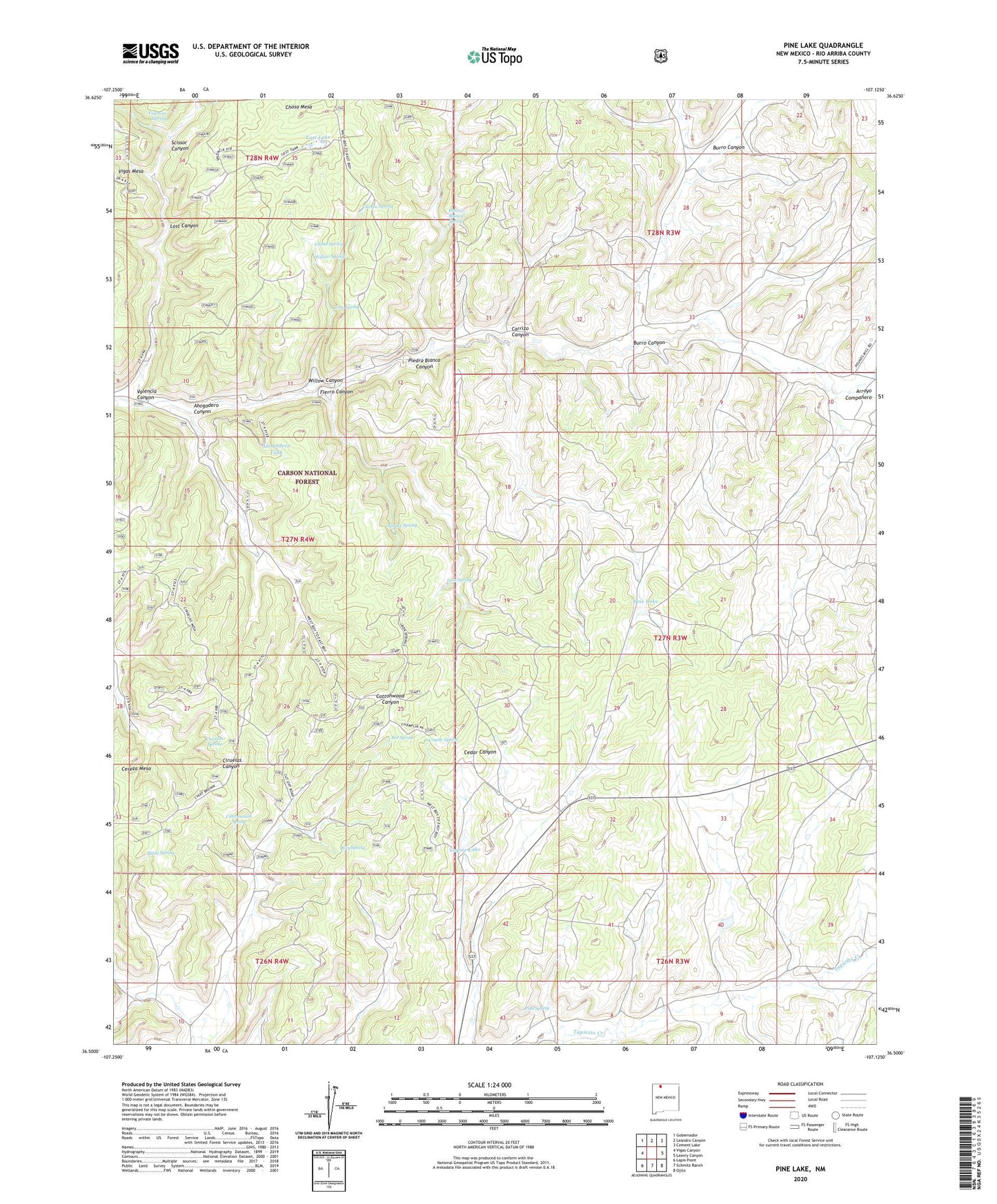
2020 topographic map quadrangle Pine Lake in the state of New Mexico. Scale: 1:24000. Based on the newly updated USGS 7.5' US Topo map series, this map is in the following counties: Rio Arriba. The map contains contour data, water features, and other items you are used to seeing on USGS maps, but also has updated roads and other features. This is the next generation of topographic maps. Printed on high-quality waterproof paper with UV fade-resistant inks.
Quads adjacent to this one:
West: Vigas Canyon
Northwest: Gobernador
North: Leandro Canyon
Northeast: Cement Lake
East: Leavry Canyon
Southeast: Ojito
South: Schmitz Ranch
Southwest: Lapis Point
Contains the following named places: Ahogadero Canyon, Ahogadero Tank, Bee Spring, Burro Canyon, Campo Spring, Chosa Mesa, Chosa Spring, Ciruelas Spring, Ciruelas Well, Cottonwood Spring, Counting Pens Water Well, Coyote Lake, Coyote Spring, Coyote Tank, Fierro Canyon, Iron Spring, Jicarilla Apache Indian Reservation, Lime Spring, Lime Tank, Lost Canyon, Lost Lake, Lost Tank, Magnolia Water Well, Pablo Spring, Pablo Tank, Piedra Blanca Canyon, Piedra Blanca Spring, Pine Lake, Pine Spring, Rim Spring, Scissor Canyon, Scissors Corral, Scissors Spring, Spruce Spring, Spruce Tank, Theodor Serafin Water Well, Valencia Canyon, Valencia Spring, Willow Canyon, Willow Spring, Willow Tank