MyTopo
Leavry Canyon New Mexico US Topo Map
Couldn't load pickup availability
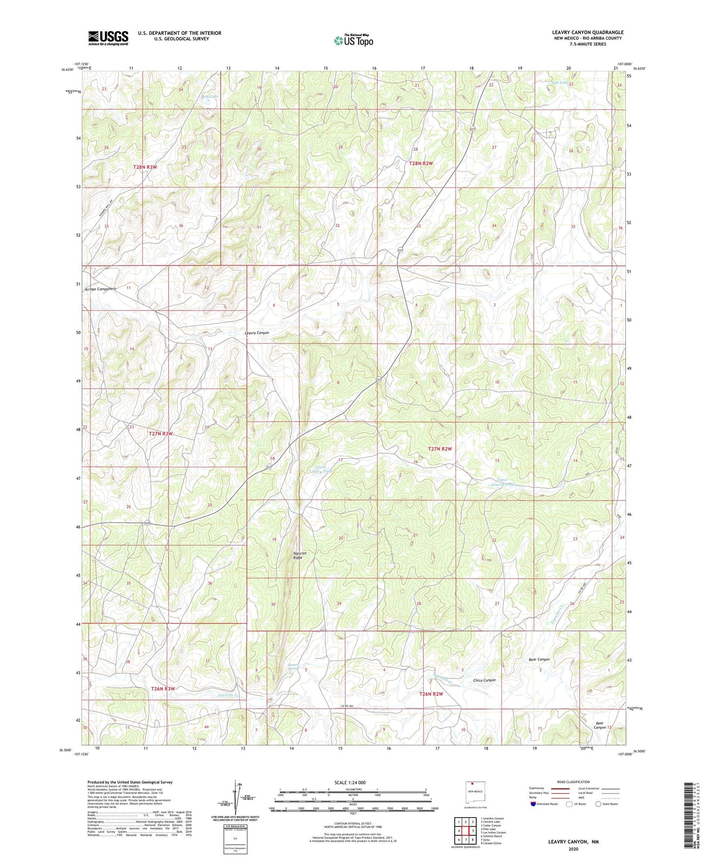
2023 topographic map quadrangle Leavry Canyon in the state of New Mexico. Scale: 1:24000. Based on the newly updated USGS 7.5' US Topo map series, this map is in the following counties: Rio Arriba. The map contains contour data, water features, and other items you are used to seeing on USGS maps, but also has updated roads and other features. This is the next generation of topographic maps. Printed on high-quality waterproof paper with UV fade-resistant inks.
Quads adjacent to this one:
West: Pine Lake
Northwest: Leandro Canyon
North: Cement Lake
Northeast: Cedar Canyon
East: Los Indios Canyon
Southeast: Canada Ojitos
South: Ojito
Southwest: Schmitz Ranch
This map covers the same area as the classic USGS quad with code o36107e1.
Contains the following named places: Bassett Spring, Bear Canyon, Chico Canyon, Edward Velarde Water Well, Five Tanks Water Well, Garambulla Well, Jicarilla Apache Nation Reservation, L Garambullo Water Well, Leavry Canyon, Lincoln Velarde Water Well, Lower Leavry Pond, Red Lake, Robert Imel Water Well, Tapicito Ridge, Tule Lake, Upper Leavry Pond